
Normally, when you think of visiting Alaska, people think of visiting the clear blue glaciers by cruise ship. However, the Alaska Highway is one of my favorite drives I’ve taken, filled with dramatic mountains, vast glaciers, and an abundance of wildlife. This iconic highway is one of the most scenic and remote drives in the world and is a must do for any road-tripper.
In August 2023, I drove the Alaska Highway during a road trip from Chicago, Illinois to Skagway, Alaska (60 total hours of driving, so it took us a full week) and an additional 15 hours from Skagway to Anchorage! Then, in that September, we drove the full way back from Fairbanks, AK to Chicago. We did our best to average about 10 hours of driving per day and leave in the morning early enough to only drive in the daytime to avoid hitting wildlife – you do NOT want to hit a moose.
Disclaimer: This article is driving the Alaska Highway from Dawson Creek to Whitehorse, because from there we start driving down to Skagway on the Klondike Highway. However after that, we rejoin with the Alaska Highway towards Tok, and then drive the Glenn Highway to Anchorage. If you’re looking for a things-to-do on the full highway, you can check out my article on driving the Alaska Highway from Fairbanks! Also, we go through various stops throughout this drive that are off the highway such as Skagway mentioned above, as well as Juneau, and Glacier Bay National Park, we plan on releasing articles with more in depth guides on those areas so look forward to those!
- What is the Alaska Highway?
- Know Before You Go
- Wildlife on the Alaska Highway
- Days 1-3: Driving from Chicago
- Day 4: Dawson Creek to Muncho Lake
- Day 5: Muncho Lake to Whitehorse
- Day 6: Whitehorse to Skagway
- Day 7: Skagway to Haines Junction
- Day 8: Haines Junction to Tok
- Day 9: Tok to Anchorage
- Where to Next?
What is the Alaska Highway?
Initially named the Alaskan-Canadian (Alcan) Military Highway, the Alaska Highway is a 1,382 mile (2,224 km) highway originally built for the lower-48 states to connect to Alaska across British Columbia and Yukon. The construction of the road begain in 1942, by over 10,000 men, to help in the creation of a supply route to connect these regions. The road was finished in 1943, and luckily is much more safer to drive now than it was then! Since the completion of the road, many sections have been realigned and rerouted, lowering the road from the original length of 1,700 miles to the current 1,387 miles, and also paving the road throughout the entire length.

Know Before You Go
- How long does it take to drive the Alaska Highway?
- Depends on your schedule! The Alaska Highway runs from Dawson Creek, BC to Delta Junction, AK, which itself takes an average of 25 hours to drive at a total of 1,387 miles (or 2,232 kilometers). However, the overall driving time will depend on how often you want to stop and where you want to visit. The average amount of time most people take is 6-10 days, but it depends on where you’re coming from, how long you want to spend in each destination, and how often you want to stop for amazing views and hikes!
- When is it best to drive the Alaska Highway?
- The best months to visit Alaska and drive the highway is summer (June-August), but tourists will typically drive from May through September. Anything outside these months would require tire chains for the snow. I cut it a little close by driving back to Chicago in late-September, but luckily snow didn’t fall until the week after!
- Are there services (fuel, food, water)?
- Between towns, not really. Plan for 100 to 150 miles without service between towns in the most remote parts of the highway. You’ll see many road signs that show “no services for X (usually between 50 – 150) miles” for a good stretch of the highway. I would recommend filling up on gas basically at each chance you can to avoid running out. It’s also best to ensure you have food and water to have in the car with you for emergencies. Cell phone service is pretty spotty if you’re not in a town like Whitehorse, Fort Nelson, Dawson Creek, etc.
- Is it paved/do I need a 4WD vehicle?
- No. The entire highway is completely paved. However, I would be prepared to have to drive on some rocky parts since there was a good amount of construction going on. This was especially present once we crossed from Canada into Alaska, on the section of the highway before Tok.
- How much will it cost?
- This is a tough one to answer! Assuming you are driving your own vehicle, and are staying at a budget accommodation (and not a campground – which would be cheaper), we averaged around $100 a night for accommodation. Outside of accommodation, the primary costs relate to food and gas.
- As you would imagine, gas is much more expensive on the Alcan, and there really is nothing to do to help lower that cost. You are driving a lot of miles (around 1,250 miles from Dawson Creek, BC to Tok, AK, where we turn off the Alcan). Also in general, gas prices in Canada will always be higher than those in the US. For example, throughout the Yukon, as of October 2024, the average gas price is around $1.99 CAD / Liter, which translates to around $5.50 USD / gallon. That is higher than the price of any US state, even California, which as of that date is $4.65 USD / gallon, and much higher than the average in our state of Illinois at $3.50 USD / gallon.
- There are not that many restaurants or larger grocery stores along the highway outside of major communities such as Fort St. John and Whitehorse. However, it isn’t too difficult to make sure to stock up in those communities, therefore saving money from purchasing food from smaller stores in other places, as well as saving money from eating out!
- While it may be hard to put an exact price on the cost of our trip up and down the highway, we think that if you have a relatively high MPG car, purchase gas and food in larger communities when available, and stay at budget accommodations, it is not too difficult to travel the Alcan on a budget! We think that the cost was truly worth the experience of seeing the beautiful nature and wildlife, and also is cheaper (and much more fun) than shipping your car, as it is another option for many people. From a recent look, it costs around $2,350 to ship a small car from Washington (the closest to AK and the lowest rates) to Anchorage, or over $2,850 for a larger vehicle!
Wildlife on the Alaska Highway
General Tips: We totally recommend avoiding driving at all in the dark, and especially during dawn or dusk if possible as that is usually when wildlife is most active. It’s great to try to time your arrival to your next accommodation with some time to spare, as it is very likely throughout your day of driving you may see a beautiful viewpoint, some wildlife, construction, accident, or something else to delay you! Having as much time as possible to not completely rush the drive lets you enjoy the amazingly unique and remote part of the world.
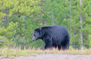
Bears – Expect to see both black bears and grizzly bears throughout the whole drive! It is hard to know for sure, but I am guessing that we saw around 15-20 of them throughout our time on the Alcan between Dawson Creek, BC and Tok, Alaska on the side of the road. They were always a great surprise to see, sometimes alone, sometimes with cubs, sometimes curious, and sometimes running away. Keep your eye out while driving, both because it is so fun to see wildlife and also to make sure you don’t hit one! And of course, keep your distance and never leave the car when bears are around.
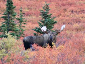
Moose – Moose were by far the animal we were the most scared of having a negative encounter with during our drive. We have seen all the advice saying that if you see you’re about to hit a deer, you should hit it and avoid swerving. However, if you realize you are going to hit a moose, you should swerve, as it usually is way more dangerous to hit it directly due to the insane size. We had seen a few moose before this, but never outside of national parks. Of any of the animals to hopefully avoid running into by driving during the day only, it is these. We did have a few unfortunately shocking moments seeing some moose sprint out of the brush in broad daylight across the road, or along the side, but luckily nothing more than that! Keep an eye out for them as they are seriously everywhere, and appreciate their giant size!
Elk and Deer – Same as moose but don’t swerve!
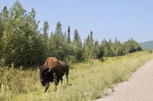
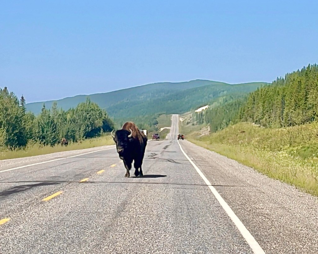
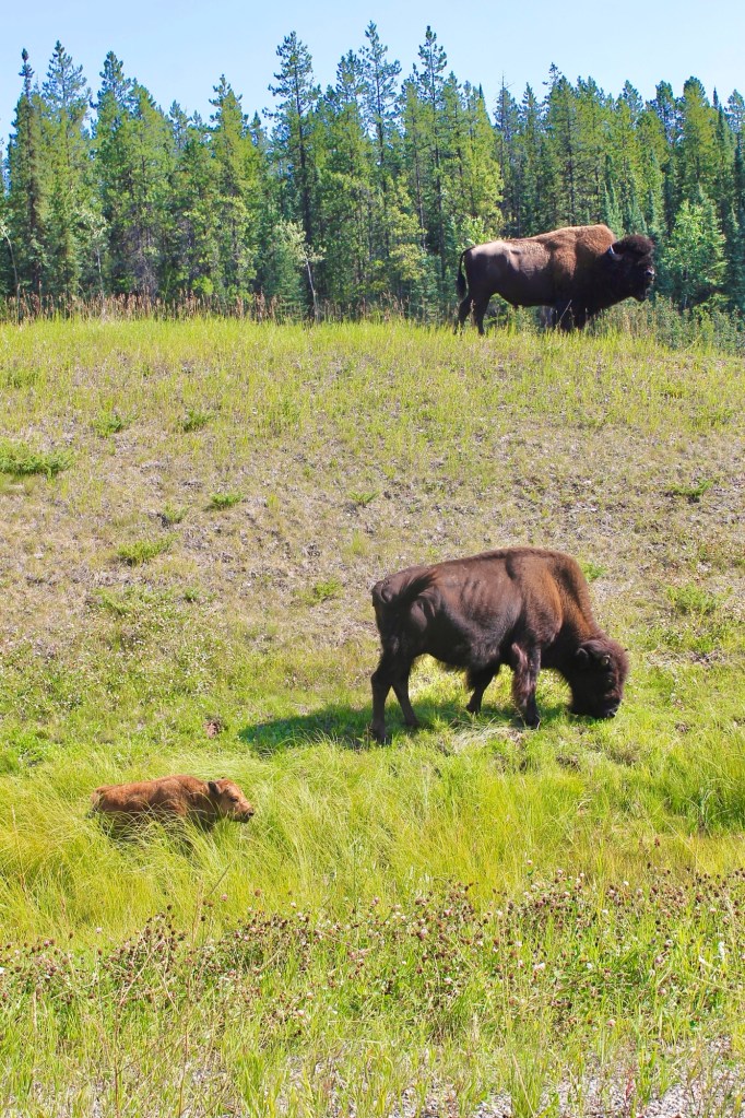
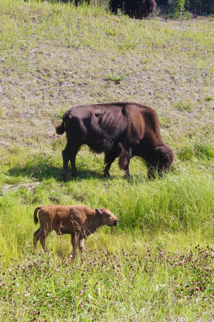
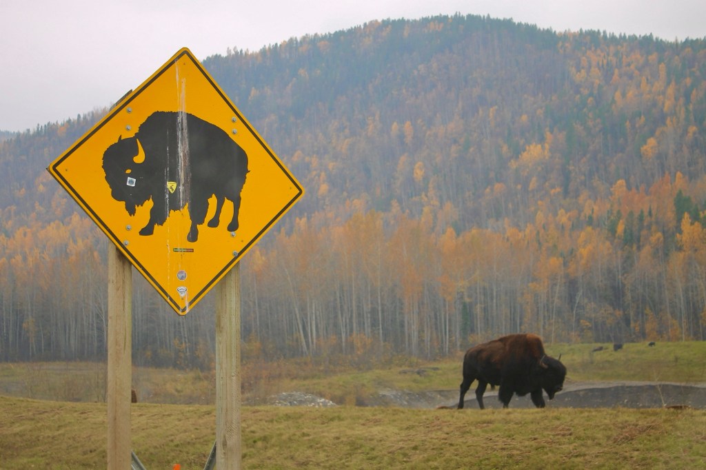
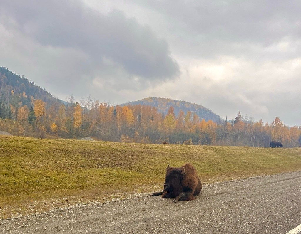
Bison – These would be another nightmare to hit in the middle of the night, probably even worse than moose, but they are also much less present throughout the drive as a whole, primarily being located in the Liard River and Muncho Lake areas in the Yukon and northern British Columbia. Keep an eye out for these as well, but as I mentioned, they are confined to certain specific areas, and there are a lot of signs around those areas so it will be hard to miss if you are in one of those areas. However, once you do find them, it is super easy to pull off (to a safe location) – and watch them relax and graze in the grass without a care in the world.
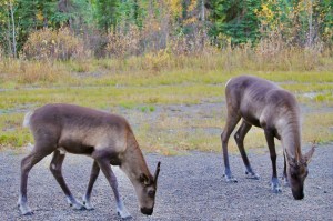
Woodland Caribou – A subspecies of reindeer (and something I did not think I could see on the Alcan, so it was awesome to see!) are most likely to be seen in the southern parts of the highway, particularly in the northern parts of British Columbia and the southern Yukon. They are commonly seen near areas like Liard River Hot Springs, Muncho Lake, and Stone Mountain Provincial Park.
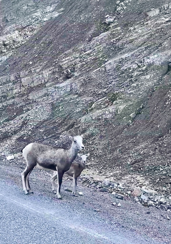
Dall sheep – A species of wild sheep found in Alaska, the Yukon, and British Columbia. With large curled horns on the males, they are most likely to be seen on areas of the Alaska Highway with steep and rocky terrain. Specific places like Kluane National Park in the Yukon and Stone Mountain Provincial Park in northern B.C. are where it is most common to see them nearest to the road.
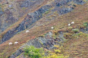
Mountain Goats – They inhabit similar terrain to the Dall Sheep as mentioned above, so look for them when you are in the Stone Mountain Provincial Park and Kluane National Park areas. They may be more difficult to spot though unfortunately as they are usually much higher up in elevation than the Dall Sheep, but keep an eye out for white dots in the distance on mountain faces you’re passing!
Days 1-3: Driving from Chicago
And our big drive begins! I’m not going to lie – these weren’t the most interesting driving days or scenery so not much for me to write about here. I didn’t even take any pictures I could add here since it was only flat grassland. We stayed in Valley City, North Dakota on our first night, Saskatoon, Saskatchewan on the second day, and Grand Prairie, Alberta on our third day.
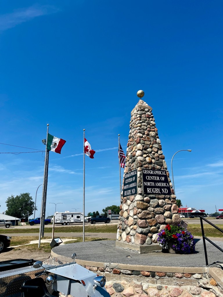
On our first day, we quickly stopped by the Geograpical Center of North America in Rugby, ND. Not much other than a little monument for it!
Depending on where you live (such as the western part of the United States), you may have a lot more beautiful scenery through southwestern Canada on your drive north to Dawson Creek. For this article, we will write it as coming from the Midwest (Chicago). How can you blame us for heading as quick we could to the Alcan (Alaska Highway)!
Day 4: Dawson Creek to Muncho Lake
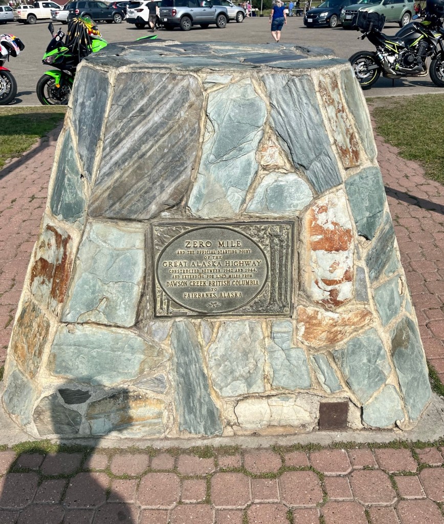
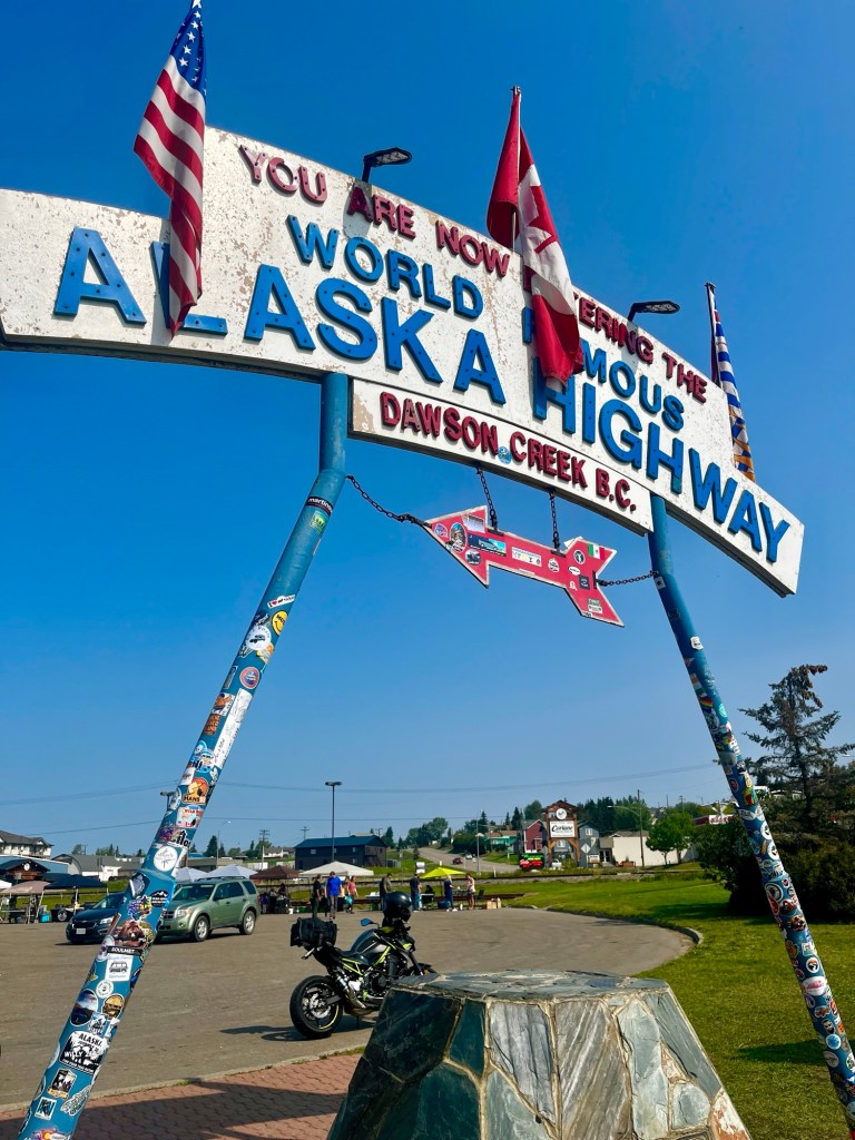
Dawson Creek
And so it begins! At Mile 0 of the Alaska Highway, Dawson Creek is where the official drive starts. This is where the iconic “Wold Famous Alaska Highway” sign is located.
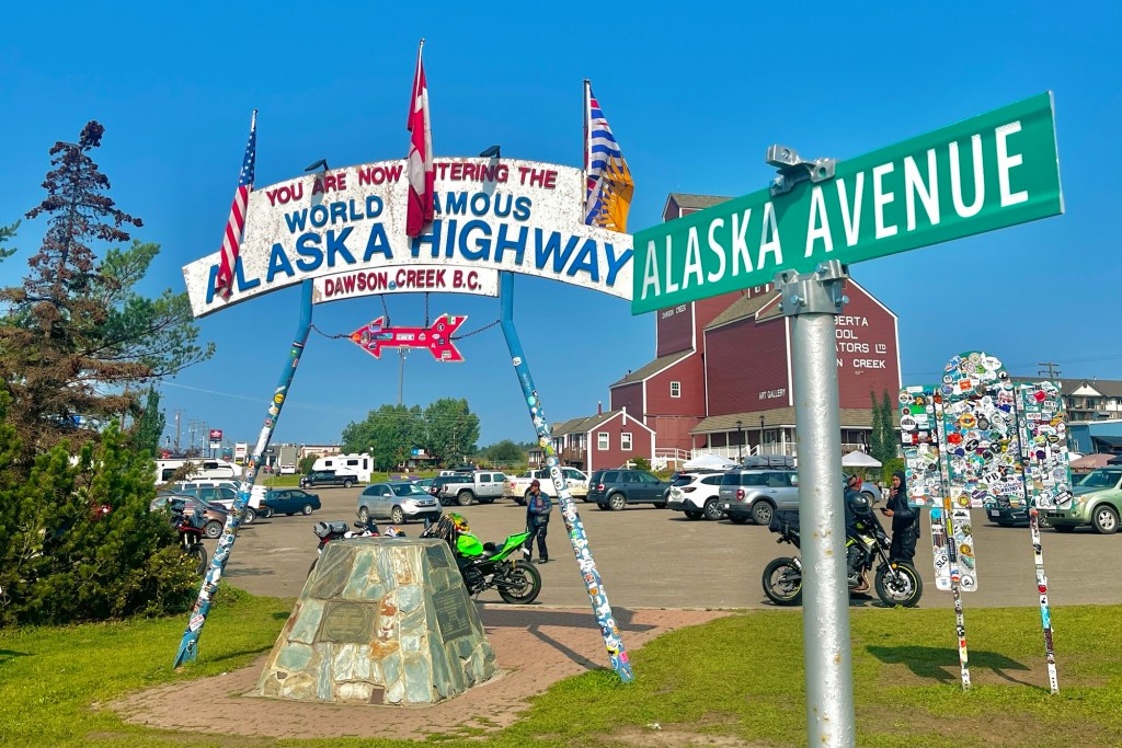
There’s a little visitor center here, as well as some cute market stalls run by locals in the parking lot. Even add a sticker to the sign if you have your own!
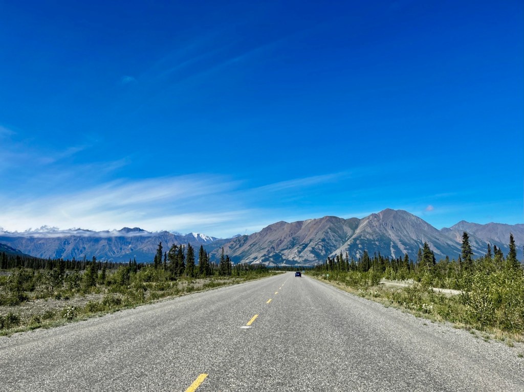
From this junction, we start to head north and begin driving through the Northern Rockies. On the drive today to Muncho Lake, you pass by two towns on the way, Fort St. John and Fort Nelson, both with populations around 3,500 people. Both of these towns have a very large gas and oil industry, which is very evident as you are driving through the towns. Both of them are a great place to stop for cheap (by Alaska highway standards) gas, as well as anything else you may need!
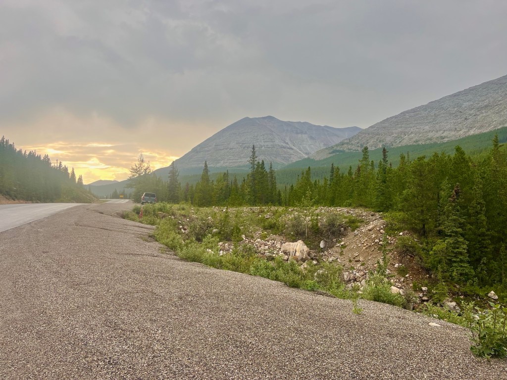
Enjoy the beautiful scenery of the Northern Rockies, and look out for wildlife such as grizzly bears, black bears, and moose! You’ll really start to see the scenery changing over here.
Toad River
At Historic Mile 422 in Toad River, you can stop at Toad River Lodge to fill up on gas, grab some food, admire the panoramic mountains surrounding you, or even stay the night in the lodges or campgrounds if your schedule allows. There’s a beautiful lake (Reflection Lake) that is a great spot for seeing wildlife such as moose, beaver, swans, and more.
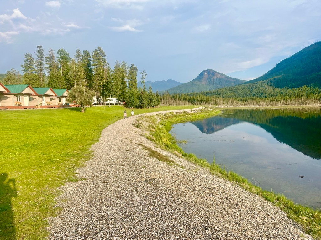
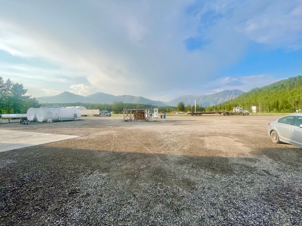
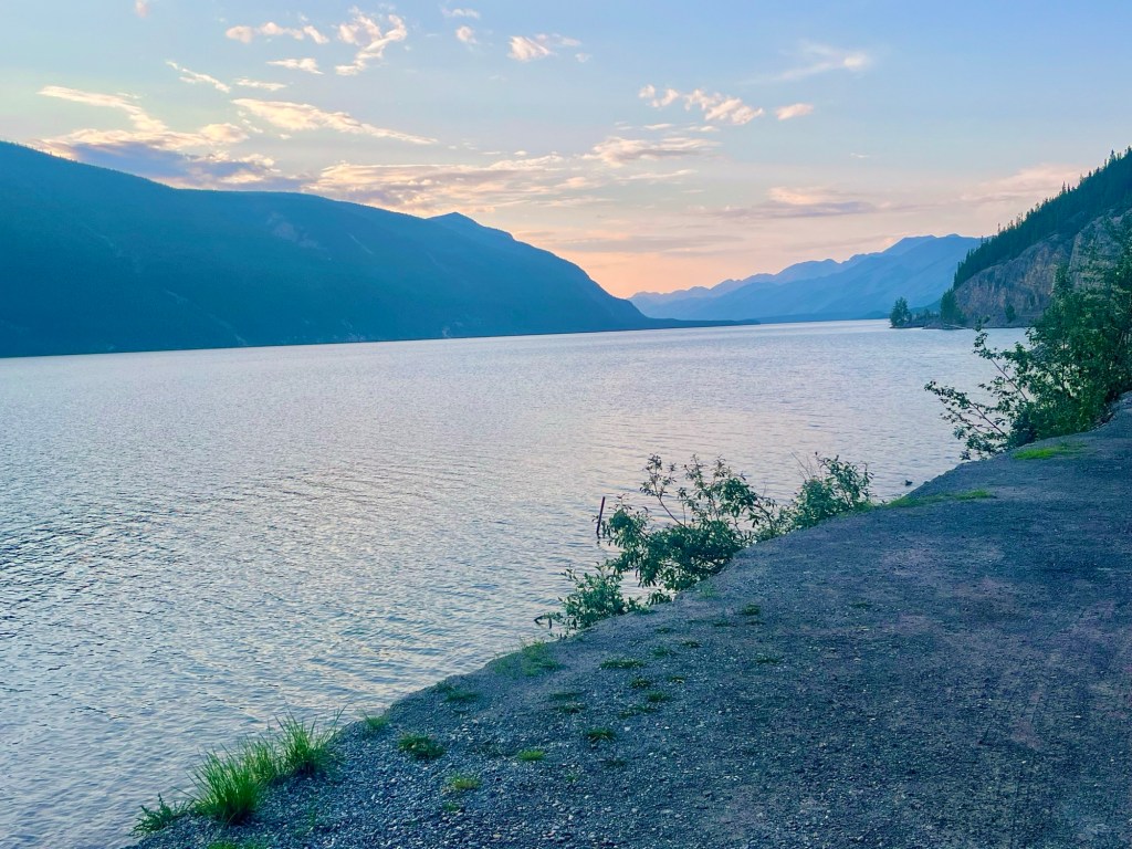
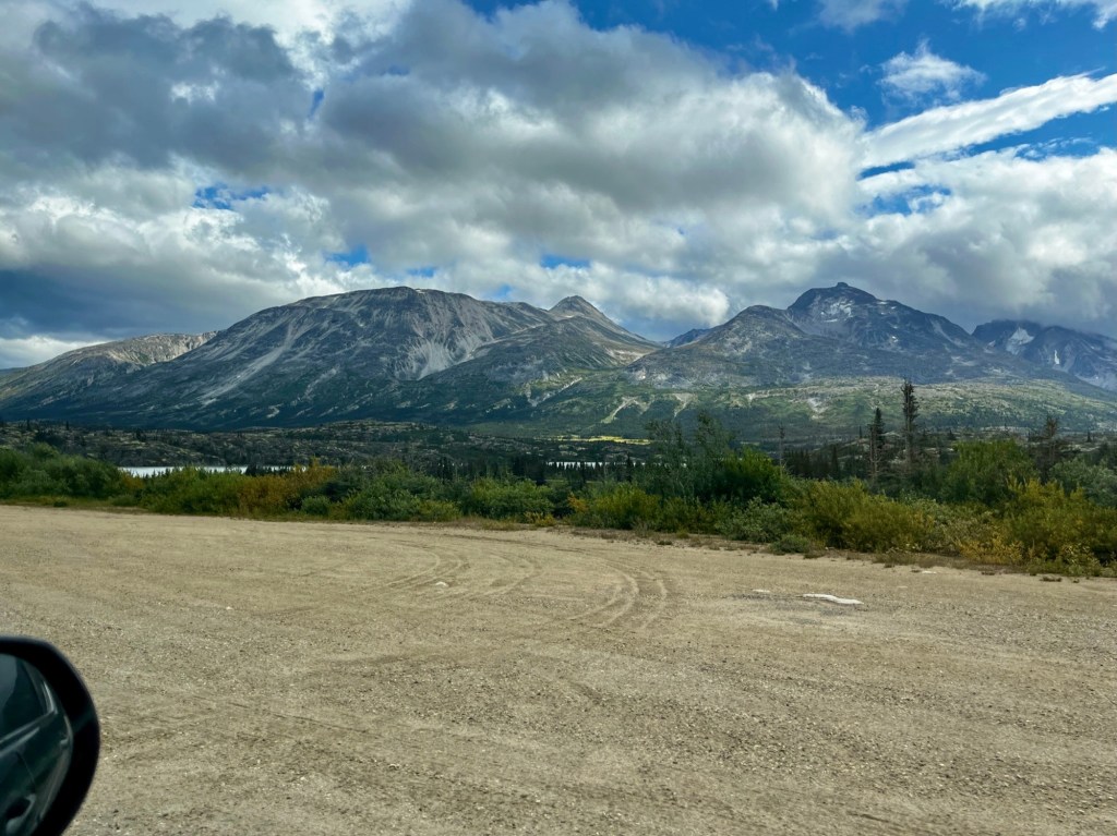
Muncho Lake
As we pulled into our accommodation, Double G Service, around sunset, we had just enough time to admire Muncho Lake itself, just a few miles away from the accommodation. This stretch of the highway felt extremely remote, even as far as the Alaska Highway goes, and it was great to enjoy the beautiful quiet of the lake and surrounding mountains.
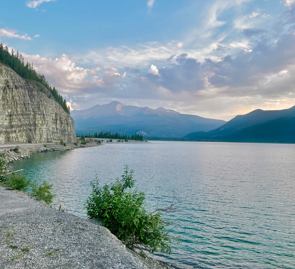
This was a good stopping point for us to rest for the night, plus the views of the lake and mountains were beautiful.
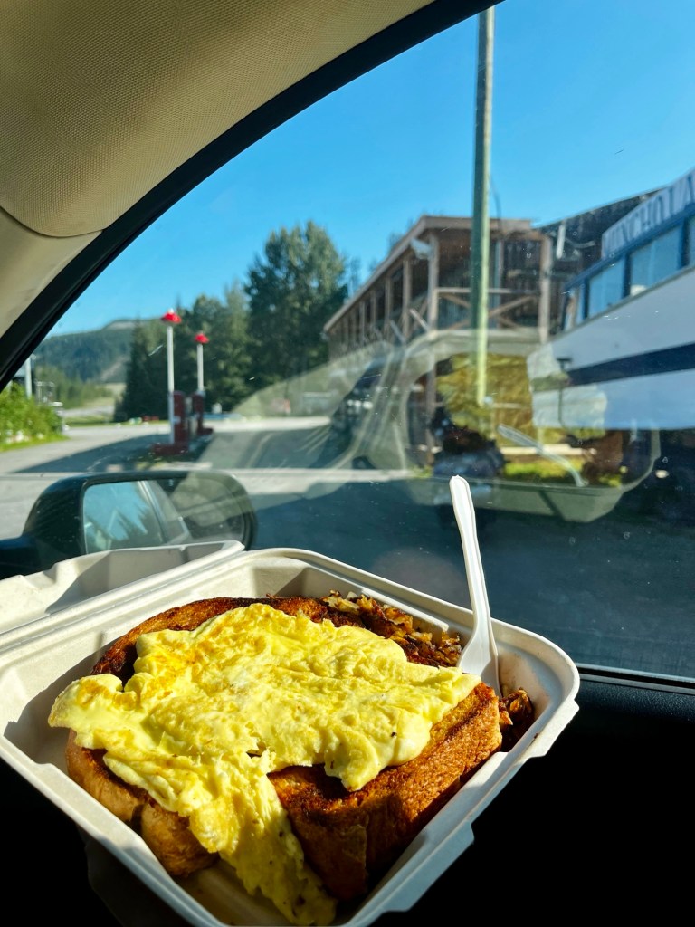
There are only a few accommodations to choose from here and we stayed at Double G Service due to it being a great budget option. We ordered the biggest piece of toast I’ve ever seen for breakfast the next morning. We also heard some great stories from truckers driving through the area staying at Double G Service, on driving other nearby highways such as the Dempster highway, that goes all the way up to the Arctic Ocean in Canada! Watch out for mountain goats along the road!
Day 5: Muncho Lake to Whitehorse
Bison Sightings
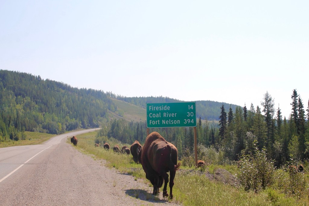
The next morning on our drive out of Muncho Lake, we ran into a herd of bison along the side of the road. We even saw one using the highway sign as a scratching post. Probably better the sign than our car (which happened to us in Badlands National Park in South Dakota, luckily our car came out unscathed)!
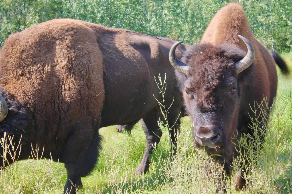
One was even in the middle of the highway walking towards us. We were going to stop and watch them graze for a while anyways, but gave us a good excuse to pull over.
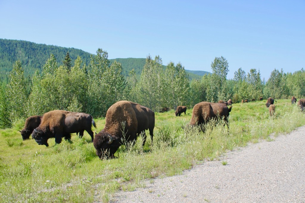
There were even a few baby calves! We stayed in our car and took pictures from the window as to not disturb them.
This herd seems to like to hang around this area near Liard River, because on our drive back to Chicago, we actually saw them again! I”m sure they added the bison sign here for a reason.
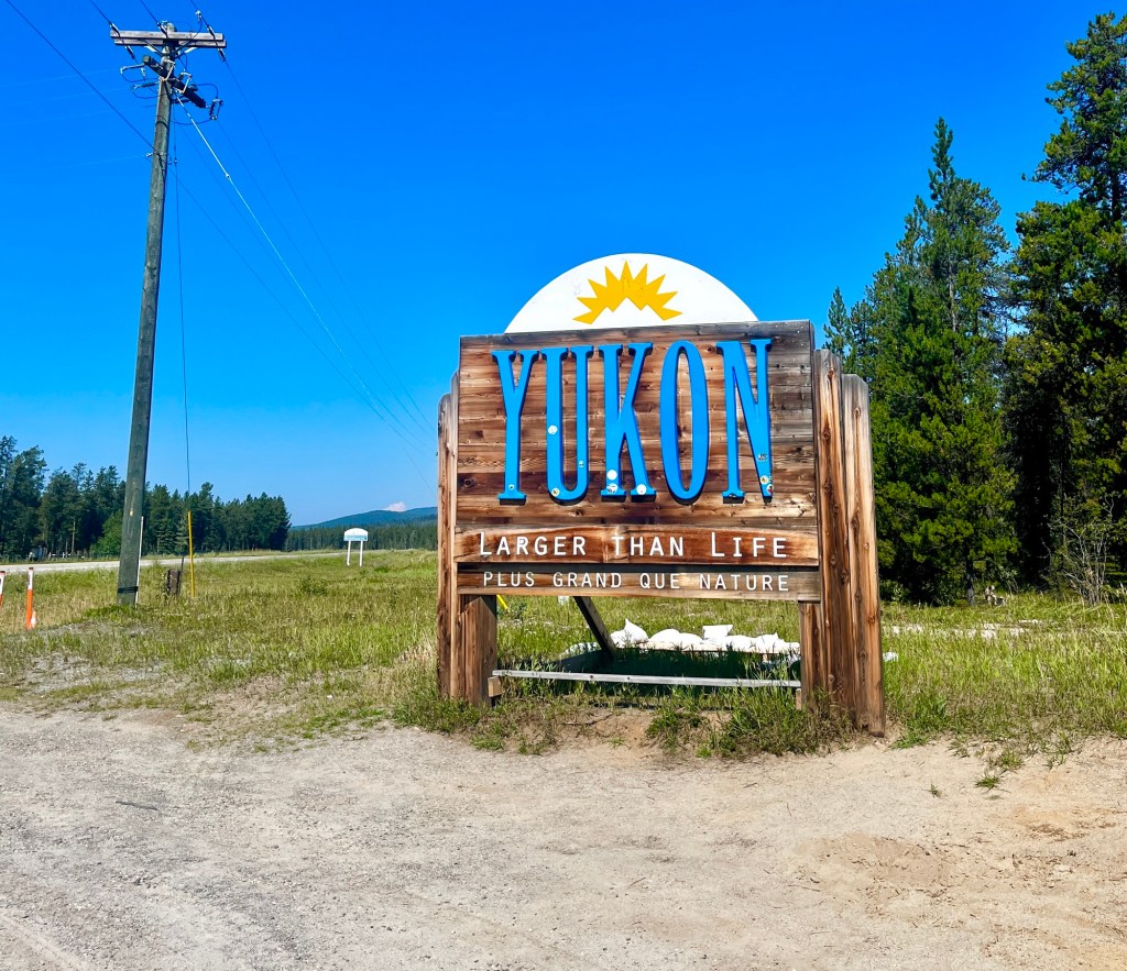
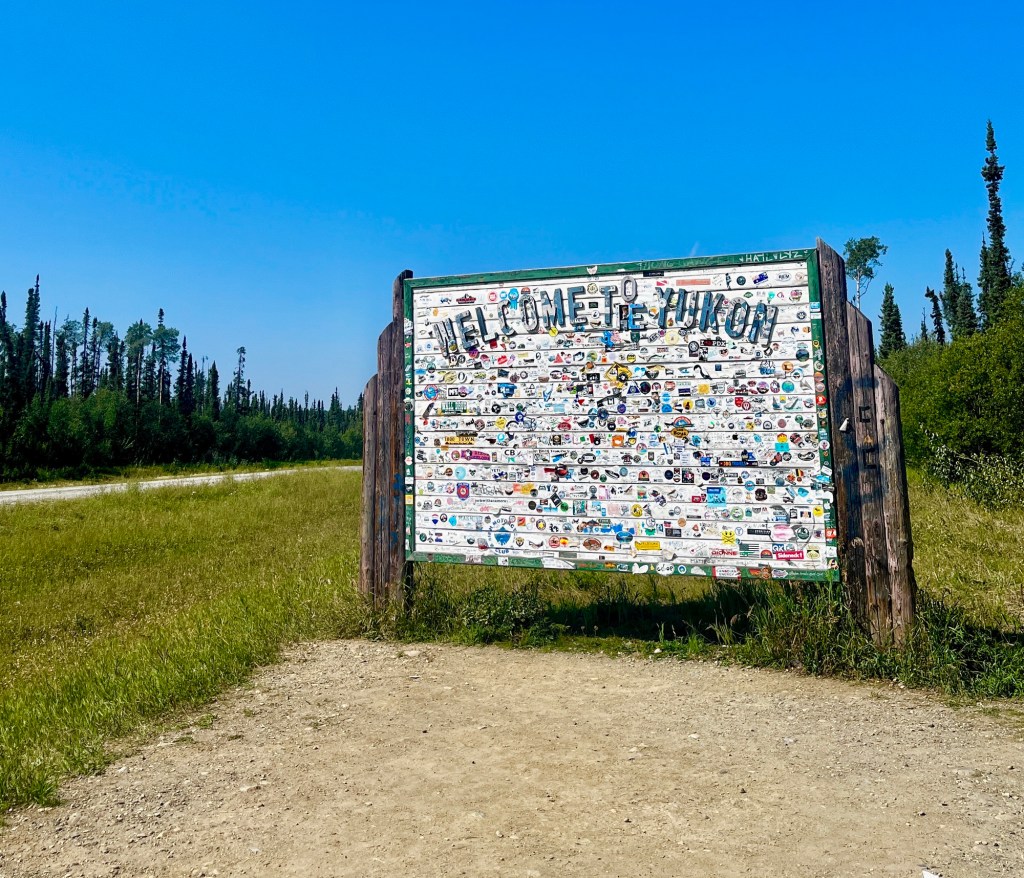
Cross over to Yukon
A little further on the road, we crossed into Yukon territory. Obviously we had to stop for the road sign to document this. Another nice sticker location.
Watson Lake
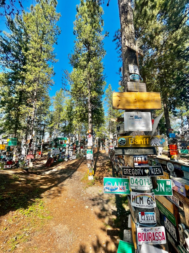
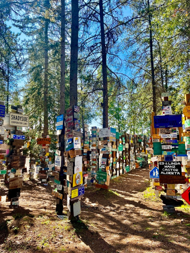
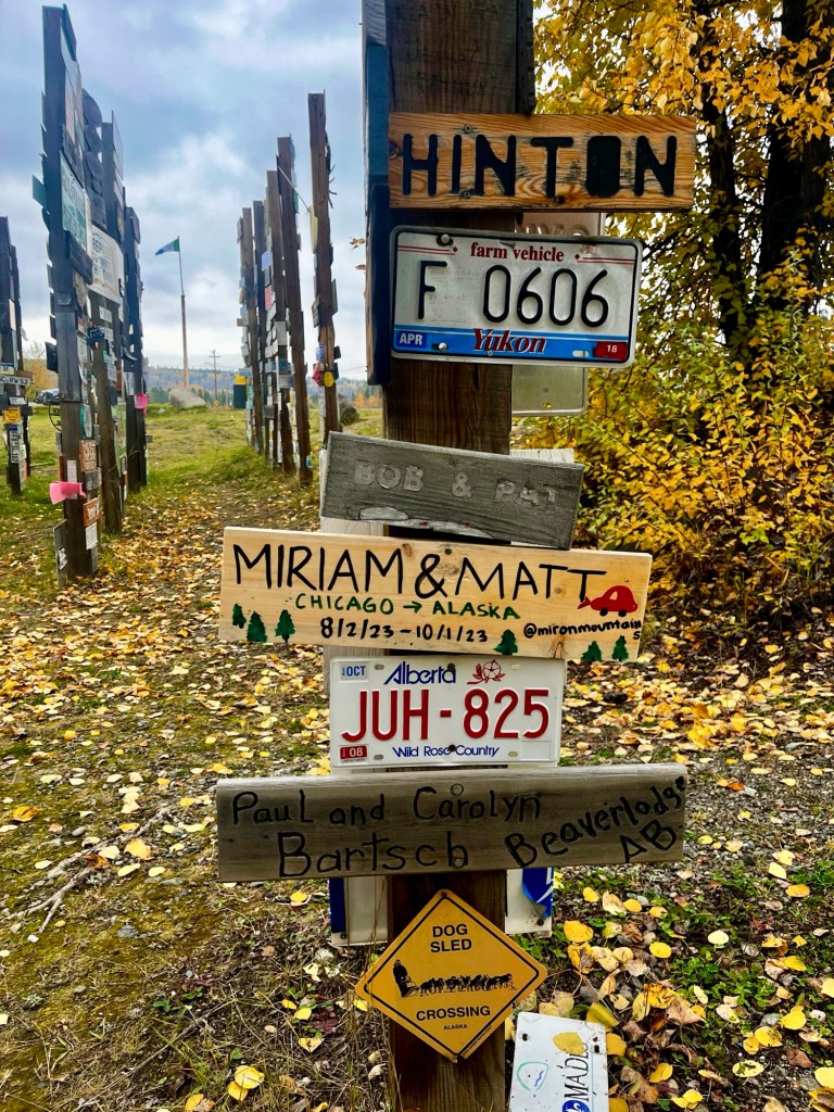
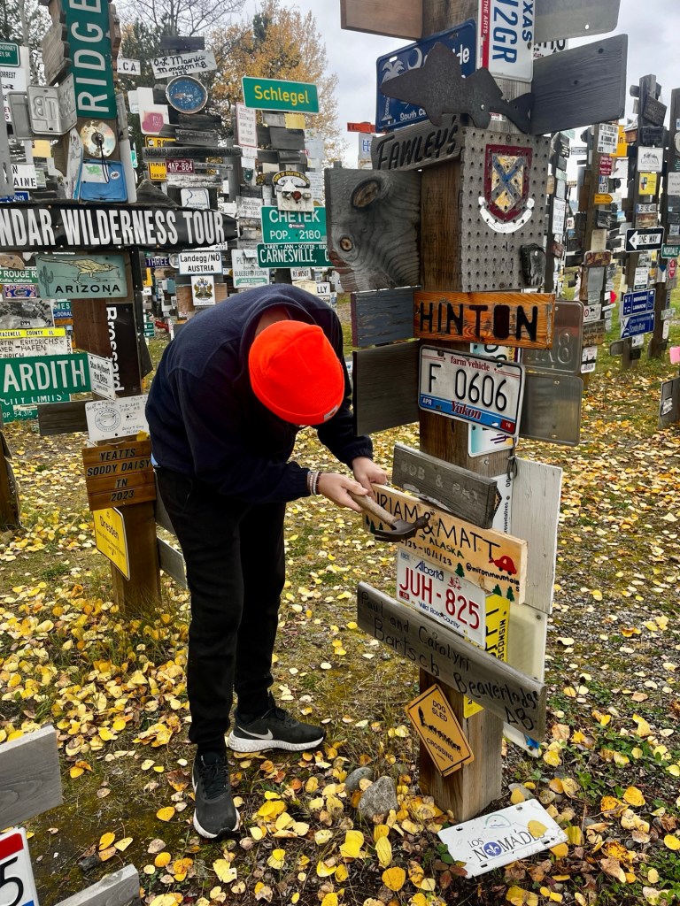
Located in Watson Lake, the next famous landmark along the Alaska Highway is the Sign Post Forest. This forest is home to over 100,000 signs and started in 1942 by a U.S. soldier who was tasked with repairing signposts and then added a sign directing to his hometown of Danville, IL (a fellow Illinoisan).
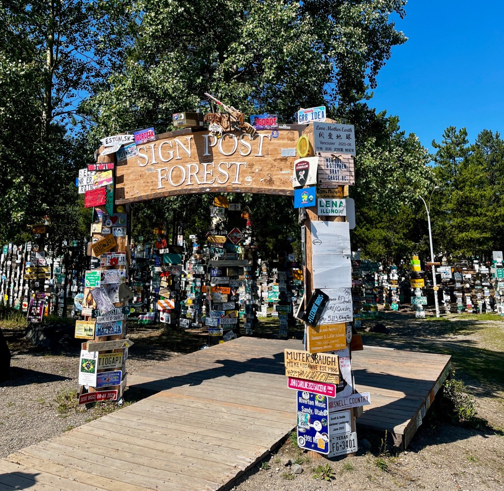
From license plates, road signs, handmade ones, and literally anything else you can nail on the post, it’s well worth to stop here and see where people are traveling from. It was cool to see people add to their own signs whenever they drove the Alaska Highway multiple times.
We even added our own homemade sign on our drive back! The Visitor Center had paint, hammers, and nails for us to create and hang our sign after easily buying a block of wood from the nearby hardware store. The hardest part was finding an empty spot to hang up our sign since the forest is absolutely filled and hammering it in was a little tough. Maybe you’ll find my sign!
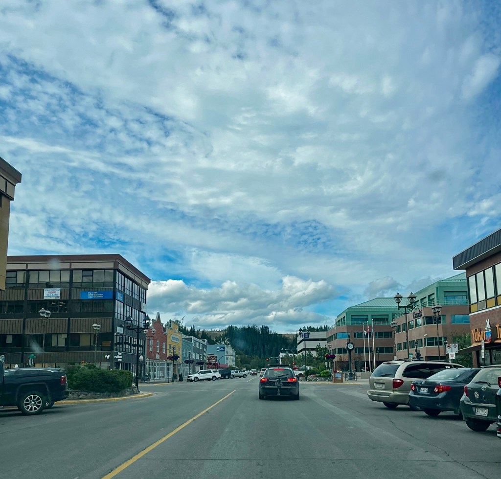
Whitehorse
After passing more scenic mountains and lakes, Whitehorse is where we rested for the night. This is the capital and largest city of Yukon, known from the 1898 Klondike Gold Rush as prospectors headed to Dawson City. The international airport within the town is likely where visitors going deeper into the Yukon will fly into for their trip. Unfortunately during our trip we did not have the time to explore too many areas within or outside of the city, but we would love to come back and explore the area further, as well as explore more remote parts of the Yukon.
One of its most popular attractions in town is visiting the SS Klondike, a giant steamboat resting on land next to the Yukon River. It is now a museum, but it used to provide a luxury travel experience sailing down the Yukon River when the Klondike Gold Rush first started.
Another popular attraction in the town is the Yukon Wildlife Preserve, which houses numerous animals that live in the Yukon that you are pretty unlikely to see in the wild, at least as far as a trip on the Alaska Highway, or a few days in the Whitehorse area. These include animals such as the arctic fox, canadian lynx, and the muskox. Furthermore by visiting, you are helping support the preserve’s mission of conserving wildlife and their habitats in the Yukon, as well as researching and the rehabilitation of injured wildlife.
The Yukon Visitor Center in town can also assist travelers in learning about other attractions in the area, such as hiking and mountain biking trails, museums, opportunities for viewing the northern lights, as well as more extensive trips into the backcountry of the Yukon. Winter trips to the area are also popular, for activties such as skiing, snowshoeing, dog-sledding,and sledding.
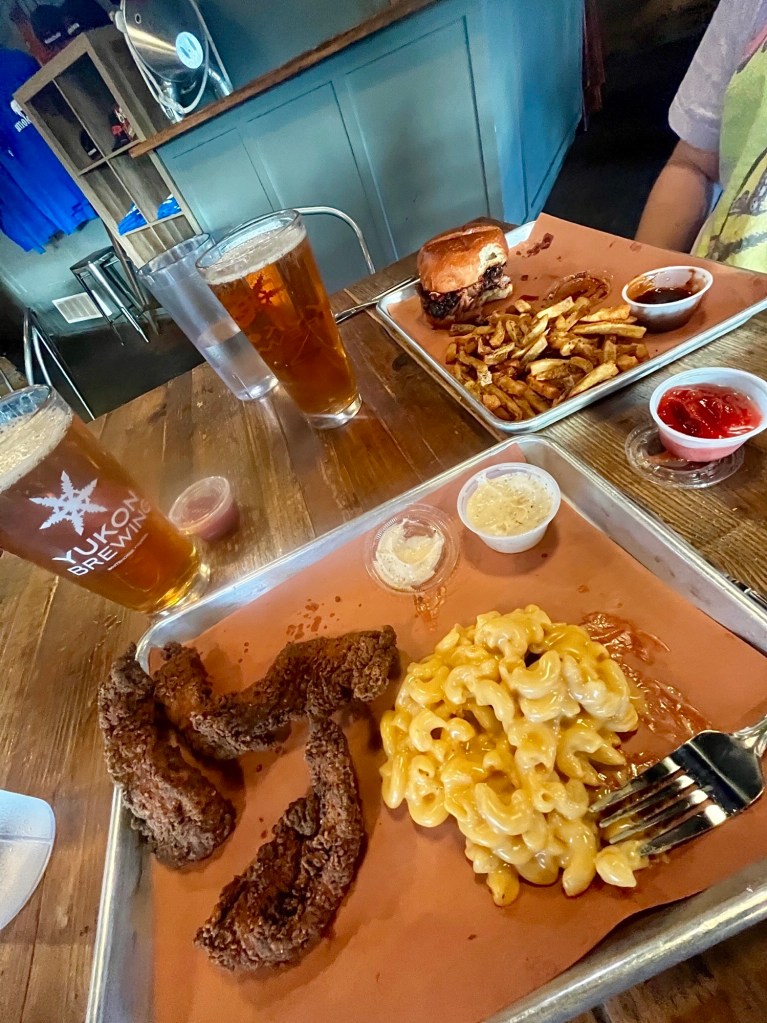
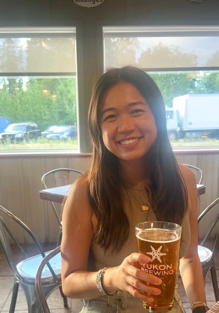
We didn’t do too much in the town since we arrived later in the day, but we did stop for a delicious bite and brew at Yukon Brewing (which we highly recommend, my photos don’t do it justice)!
Day 6: Whitehorse to Skagway
From Whitehorse, we actually turn away from the Alaska Highway and change to the Klondike Highway. If you’re not heading to Skagway, I recommend reading my article on driving the full Alaska Highway from Fairbanks (coming soon) to continue up past Whitehorse.
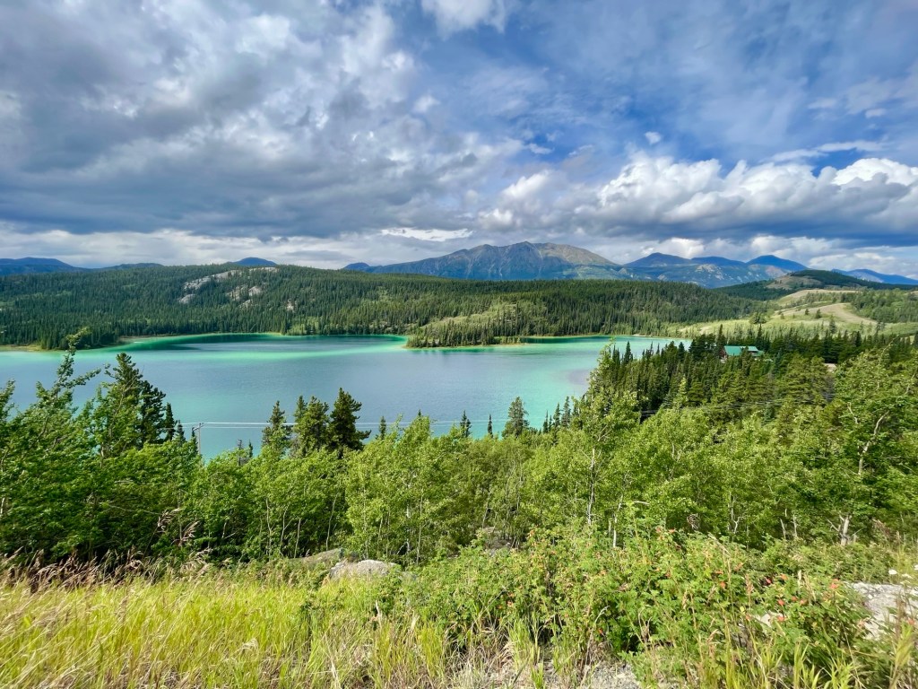
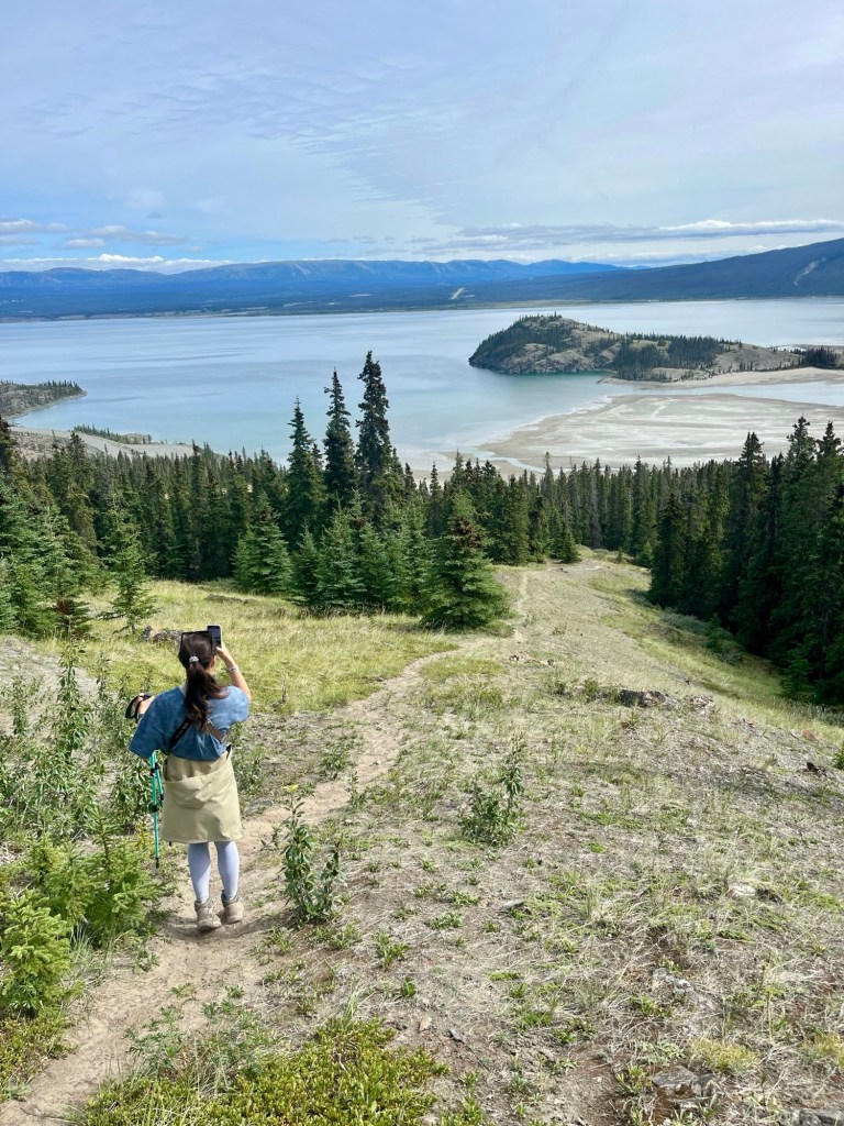
Emerald Lake
This “most photographed lake in the Yukon” is a quick viewpoint along the road you can turn off into. Created by the sunlight’s reflection off white calcium carbonate on the lake bottom, the water shows off bright green hues, particularly along the edges. As water levels rise in the summer months, the beautiful colors in the lake are more pronounced and at their peak. The nearby Emerald Lake Campground offers camping facilities for those who want to immerse themselves in the area’s natural beauty, and is a great place for outdoor activities such as canoeing, kayaking, and fishing.
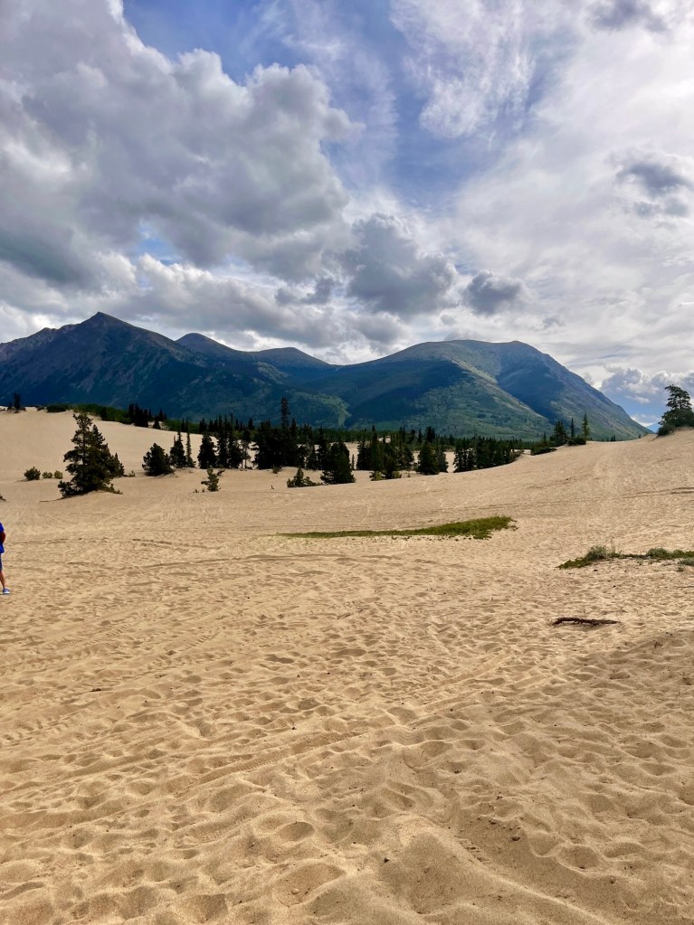
Carcross Desert
Who would think there’s a desert in the middle of the Yukon? Not only that but the smallest desert in the world! These dunes were formed as the glaciers in the last ice age melted and dried, leaving the sand behind.
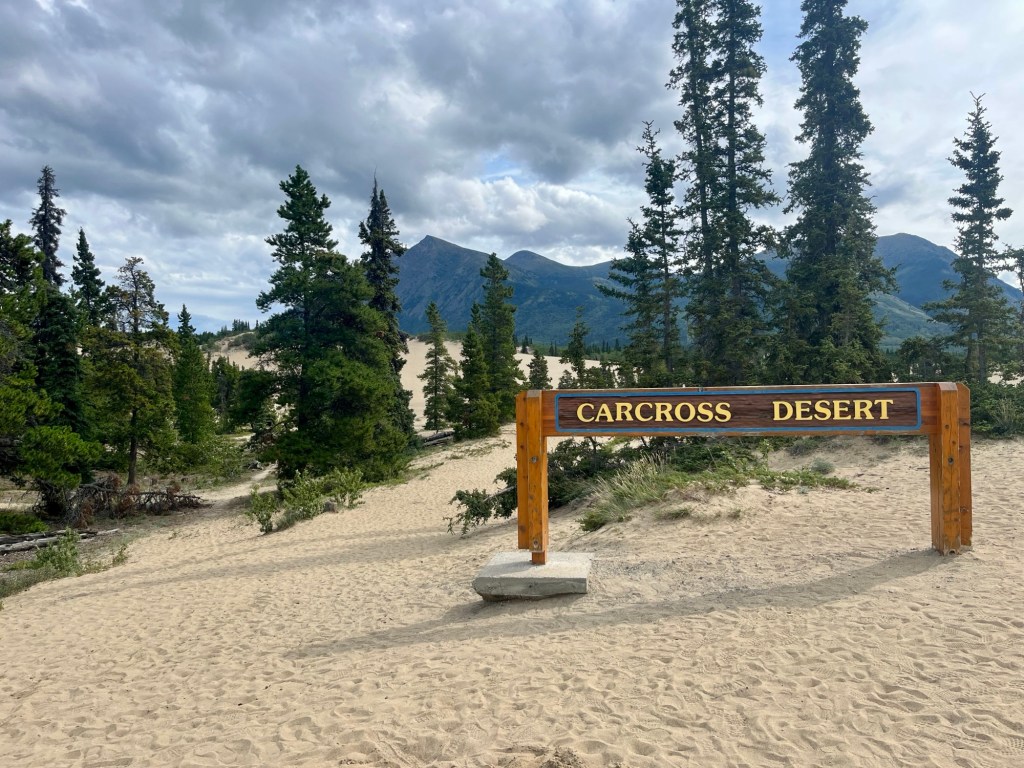
It’s a nice little area to stop and walk through the sand for a bit. The dunes are used in the summer for sandboarding, beach volleyball, hiking, ATVs, and even skydiving.In the winter, it’s a popular spot for snowmobiling and toboggans!
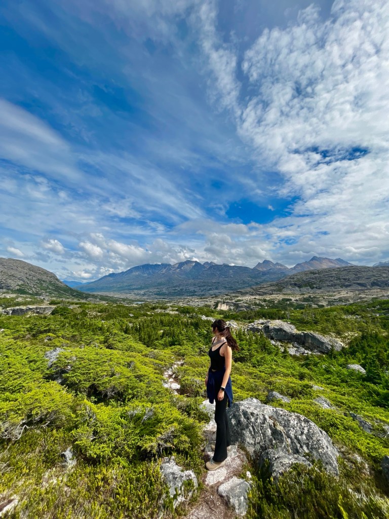
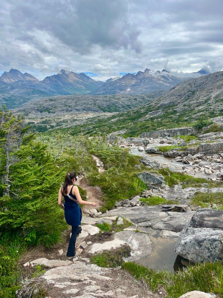
Fraser
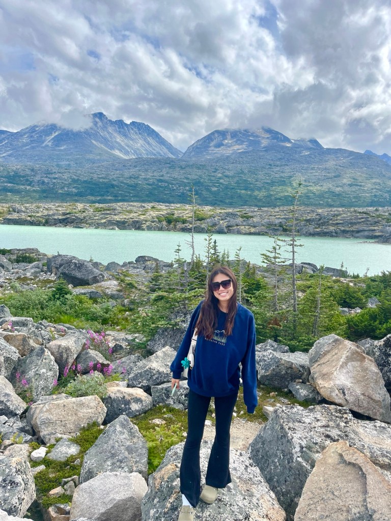
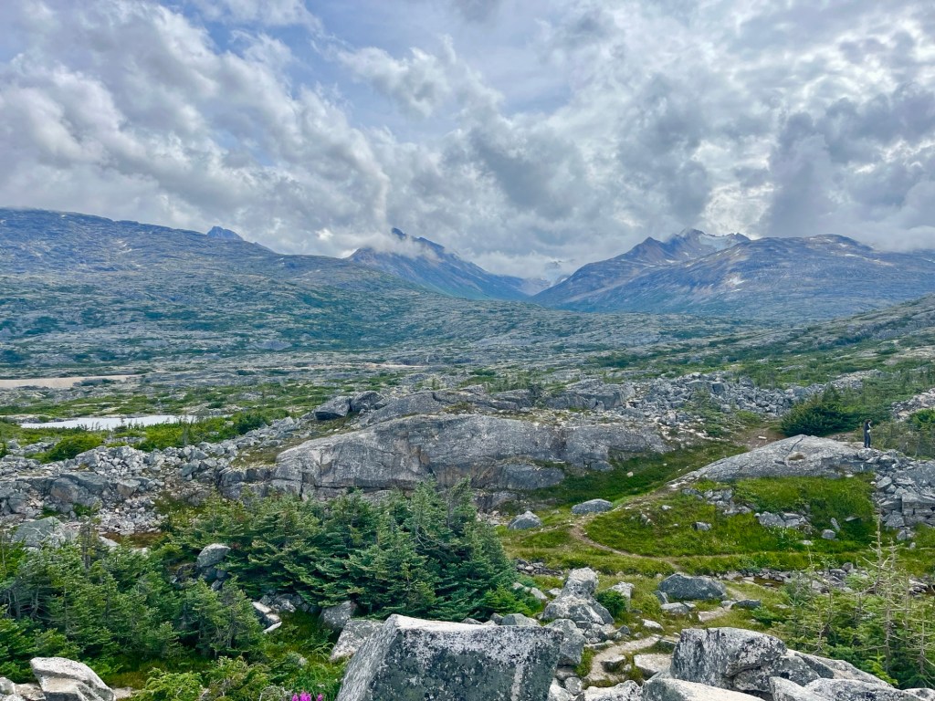
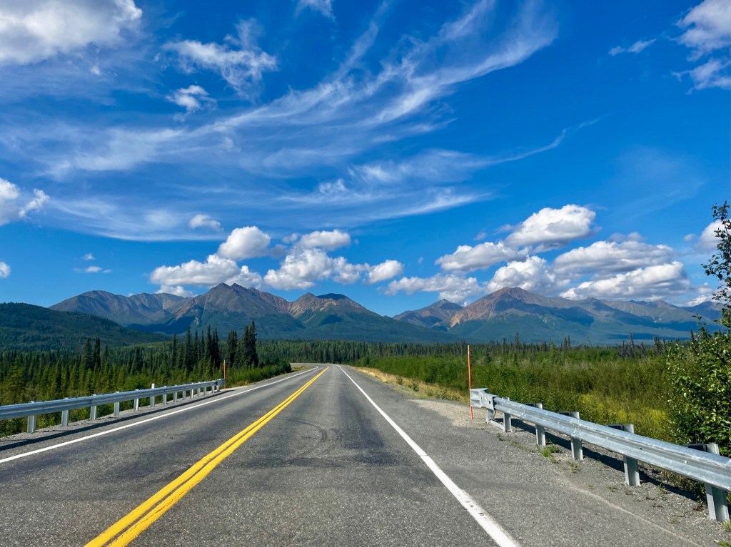
The type of unique subalpine terrain you’ll see in this section of the Alaska Highway is not usually accessible by road and consists of “moonscape” – the transition of vegetation of lower elevation trees to alpine above the treeline. As you drive following the train tracks to Skagway, the ground really does start to look like the surface of the moon.
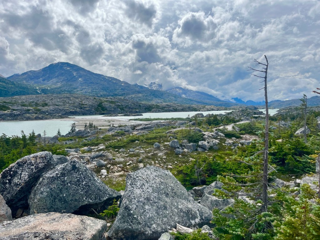
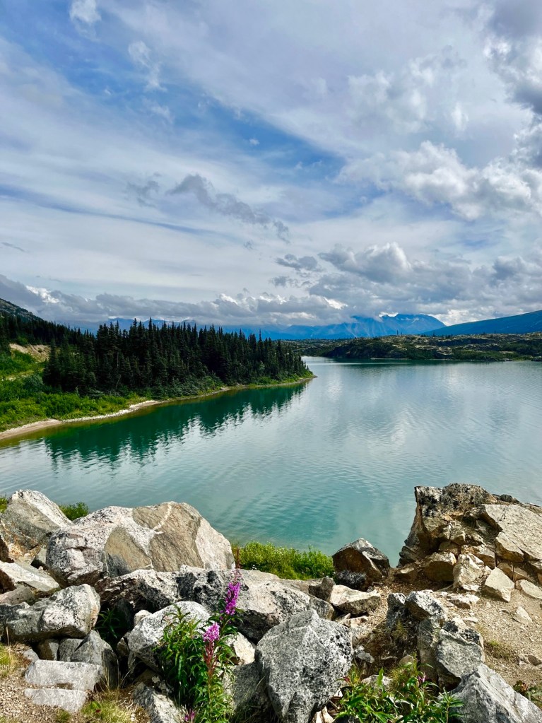
You’ll pass Fraser Lookout first, overlooking Bernard Lake and views of the White Pass railroad.
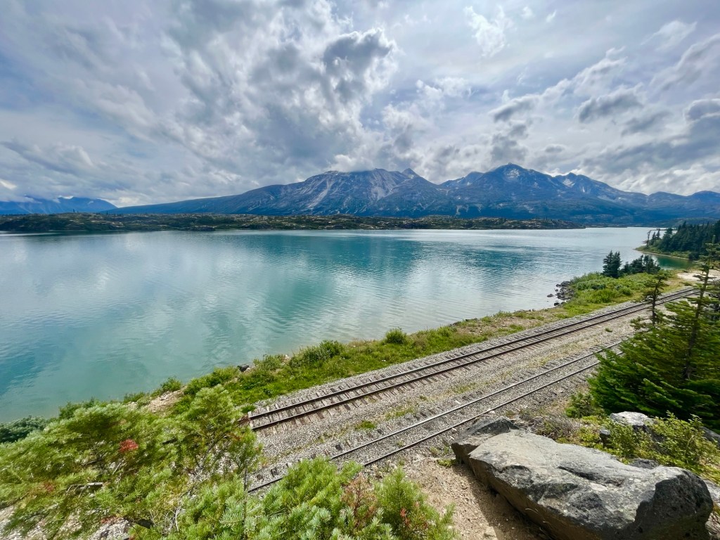
Head a little further to Summit Lake Lookout for another breathtaking view of the blue waters of Summit Lake, moonscape, and mountains.
The remote and rugged beauty of this area is hard to beat, and got us so excited to finally be nearing Alaska after almost 60 hours of driving from Chicago!
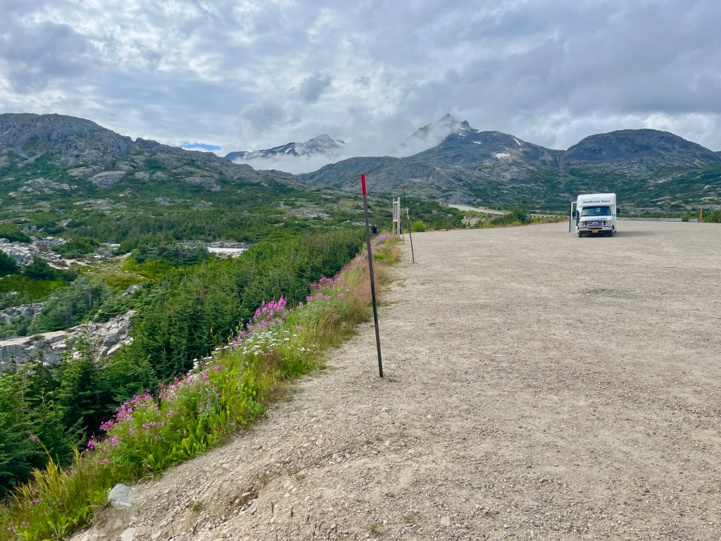
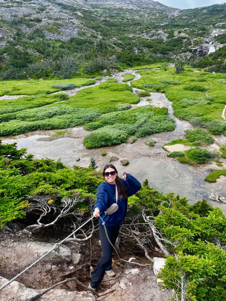
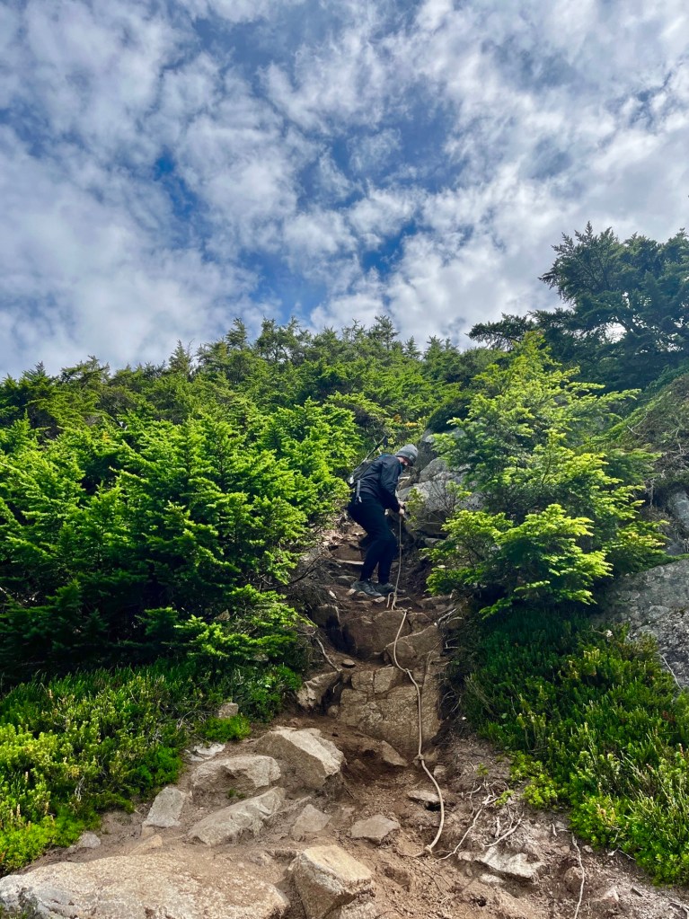
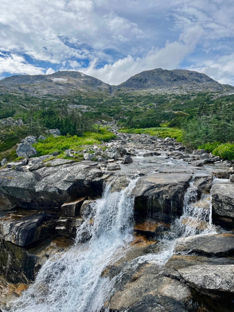
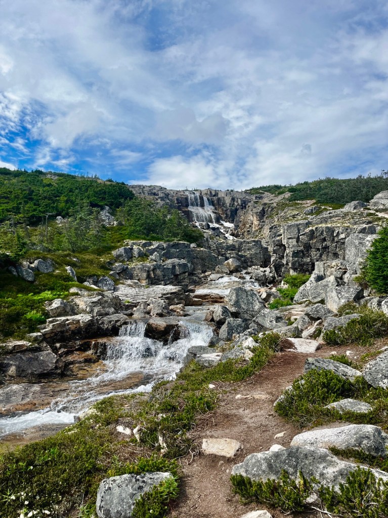
Hike International Falls
Before we drive into Alaska, we actually are going to cross over to Alaska on foot! This hike at International Falls is a beauty and you cannot miss it as you walk along a creek with waterfalls and surrounded by mountains.
On Google Maps, you’ll see a pin for “Skagway Grade Summit Rest Area” where you can park on the highway pullout for this hike. Things to note is it does involve a very steep but short descent from the parking (there’s a rope to help you), as well as a super shallow creek crossing. Once you get past this, the walk is easy-peasy!
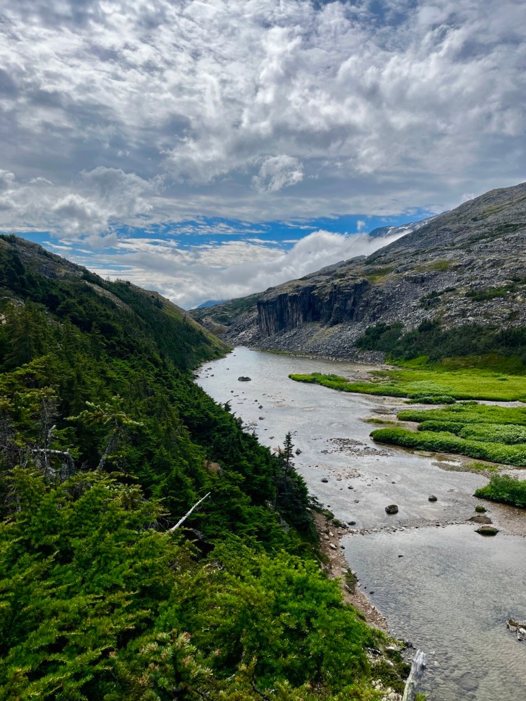
It’s kind of a choose-your-own adventure in terms of time, so feel free to make it as short or long as you’d like! The views don’t change much along the way but after hiking 1 km, you’ll be able to look over into the next valley towards Chilkoot Trail.
For those on a long day of driving, it is great to find hikes like this to get out of the car, stretch your legs, and take it slow to get some great views, without having to commit too much time.
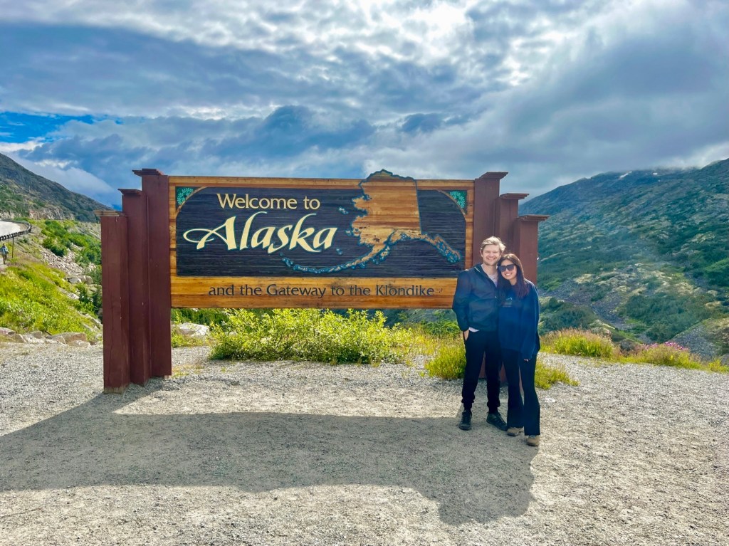
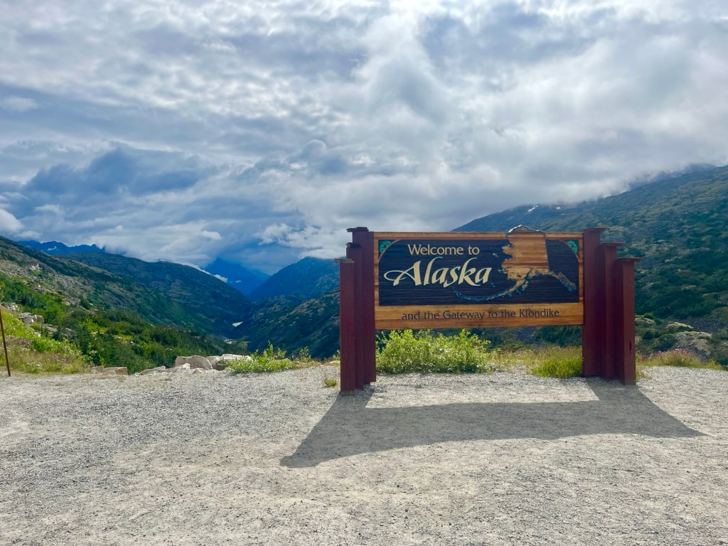
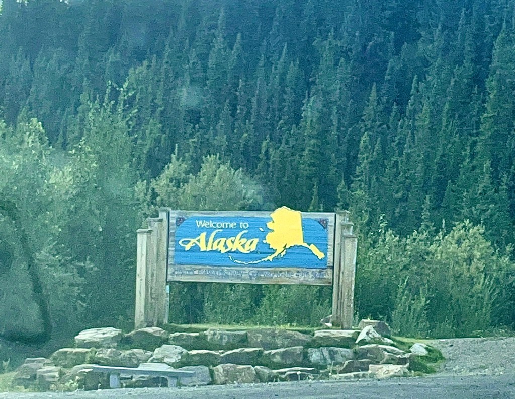
Welcome to Alaska!
After 60 hours of driving, we have finally arrived to the 49th state! We were definitely ready to be out of the car and officially in Alaska. Of course we had to stop and get a pic of the iconic welcome sign. The incredible alpine views around the area completely fit the atmosphere of what we thought our first look at Alaska would look like. Shoutout our CRV for making the journey like a champ!
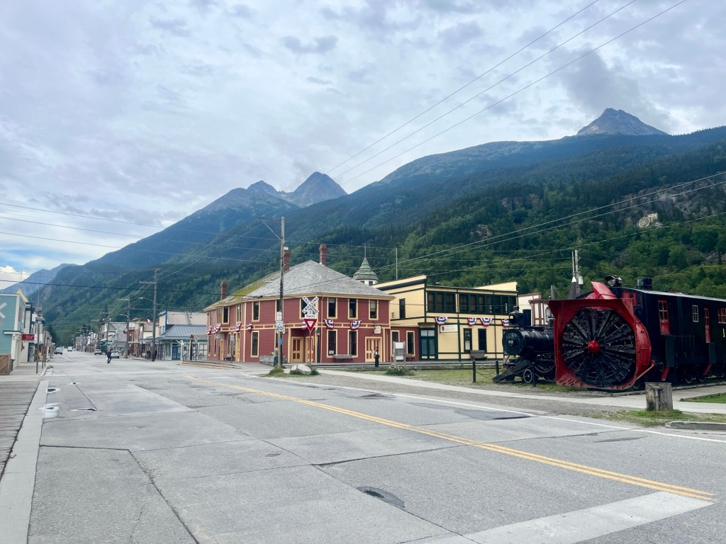
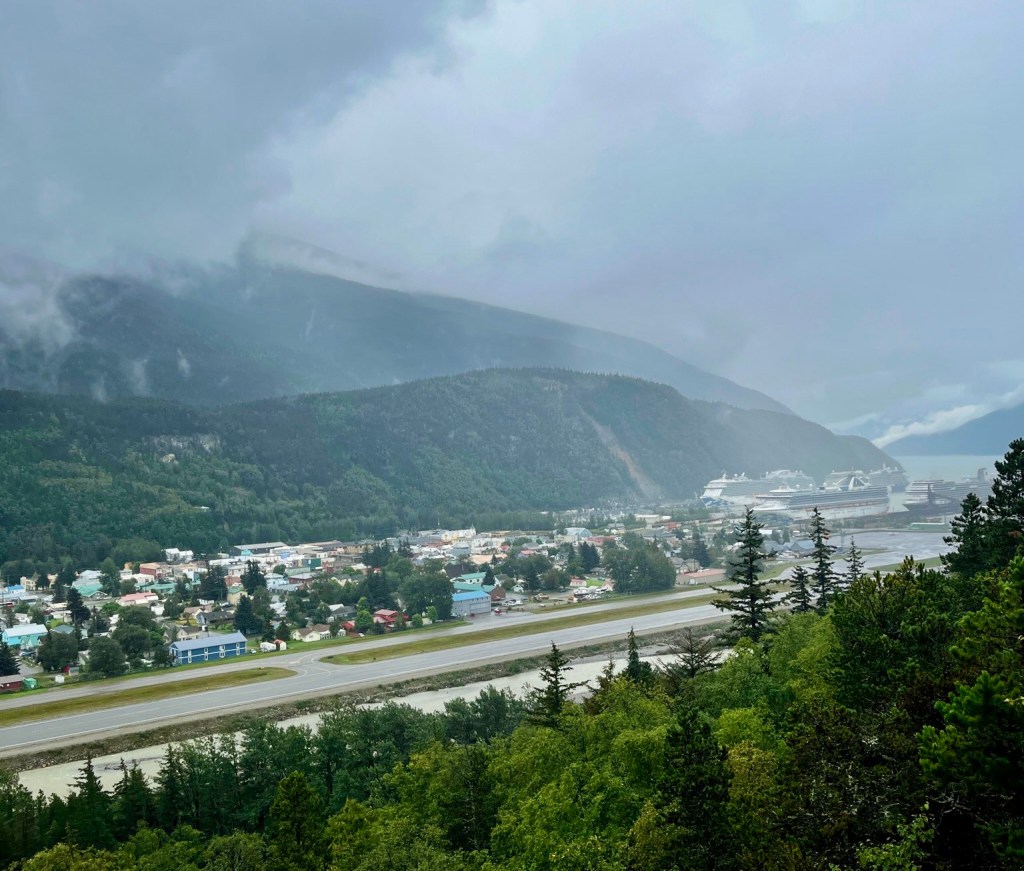
Skagway
If you think about what a historic small town during the peak Gold Rush era, Skagway (the “Gateway to the Klondike”) has those exact vibes that’ll make you feel like you’re back in the 1890s. Tourists don’t really stay here overnight as people are either coming in from cruise ships for Inside Passage tours to wander for the day or people are stopping by for the ferry to Juneau. It’s also home to the White Pass and Yukon Railroad that you drove past, known as the “Scenic Railway of the World.”
Another popular attraction in the area for more adventurous hikers is the Chilkoot Trail. This hiking trail stretches for about 53 kilometers (33 miles) from Dyea, Alaska, to Bennett Lake in the Yukon. It played a crucial role during the Klondike Gold Rush in the late 1890s, serving as a primary access route for prospectors heading to the gold fields of the Yukon. In 1998, the centennial of the gold rush, the National Historic Site on the Canadian side of the trail, joined with the U.S. National Historical Park to form Klondike Gold Rush International Historical Park.
Once again, due to time limitations, we did not have the time to hike this trail, which normally takes hikers 3-5 nights. However, from reading about the trail during our travels, and since, it looks like an incredible mix of the historical significance of the area, as well as the beautiful glacier, alpine lake, and mountain scenery throughout. If (and hopefully once!) we are back to Alaska, this is something we will be able to do!
For more details on our stay in Skagway and the area in general, check out our article on the town coming soon!
Day 7: Skagway to Haines Junction
It’s really Day 12 for us by the time we’re leaving Skagway after traveling back from the Juneau ferry, but if you were to skip Skagway and Juneau, you would be following back on this path! Get excited for our Skagway, Juneau, and Glacier Bay articles coming soon!
The next bit of this drive is a bit of a repeat, as you head back towards Whitehorse. However, luckily a “repeat” is not the right way of describing this drive, as it is absolutely beautiful every minute of the way! Enjoy the beautiful moon-scape scenery of the area between the US-Canada border and Carcross.
Also, reminder that Whitehorse is the only city with over 10,000 people within over 600 miles by road, so don’t forget to grab any supplies, cheaper gas, or whatever you may need before continuing towards Haines Junction!
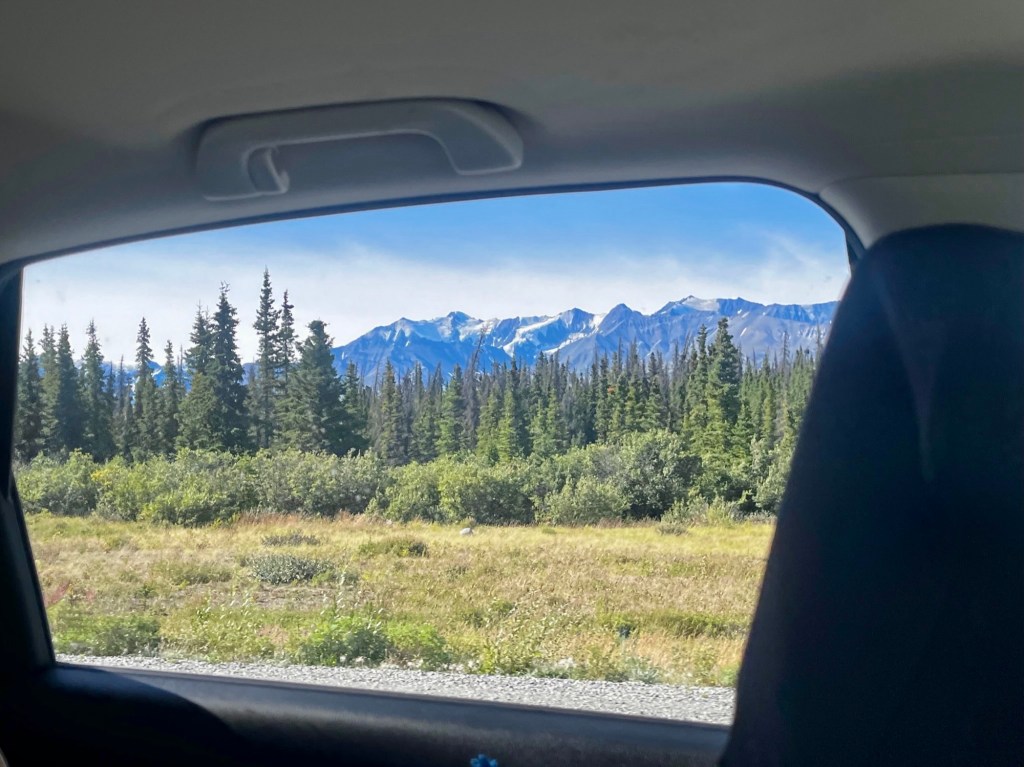
As you leave Whitehorse, you’ll start to pass the beautiful Yukon Ranges, with endless views of snow-peaked mountains and lush boreal forests (my personal favorite type of view). Keep an eye out for wildlife as this is one of the most wildlife packed parts of the drive!
Yukon Wildlife Preserve & Takhini Hot Springs
If you turn right off the Alaska Highway onto Klondike Highway, you’ll reach Yukon Wildlife Preserve and the Takhini Hot Springs. Here, you can spot Yukon-native wildlife like elk, moose, bison, arctic foxes, caribou, and more!
Takhini Hot Springs is another great place for a quick soak in its man-made pools. They are also a great spot to see the northern lights, imagine watching them while soaking in the hot springs!
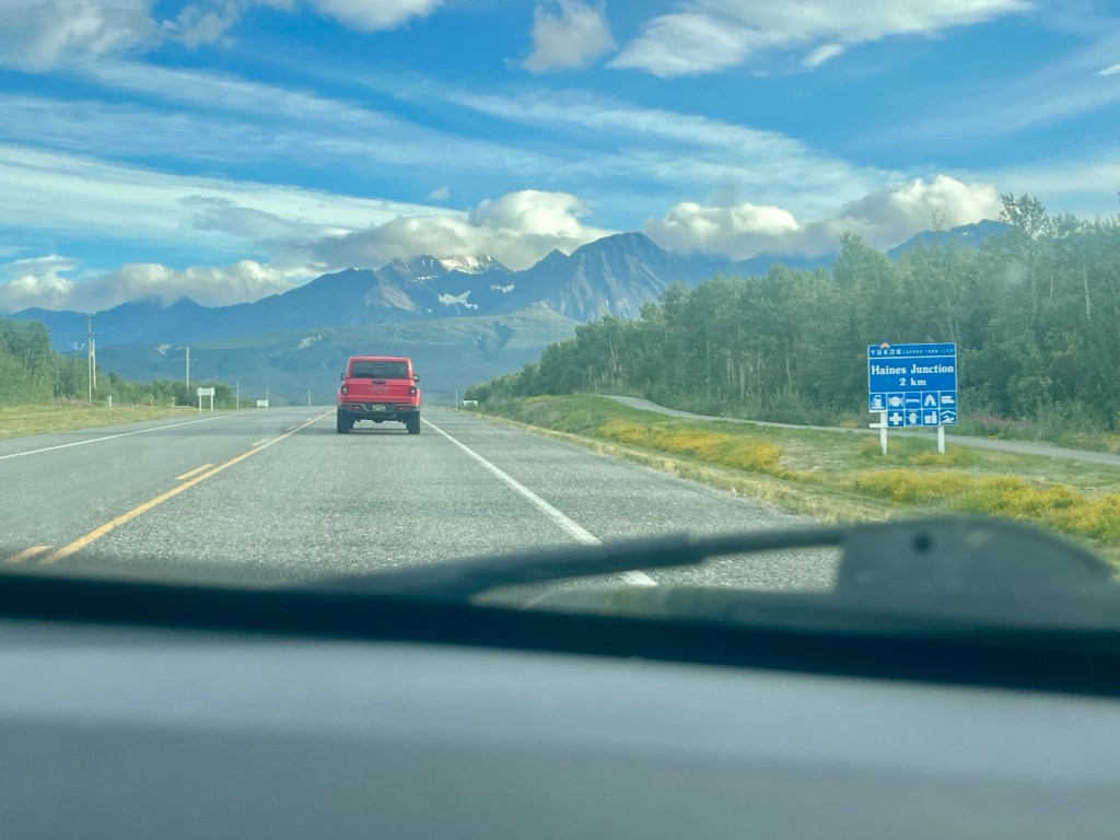
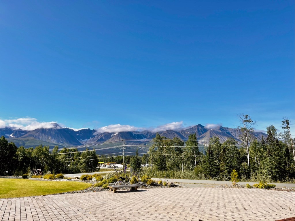
Haines Junction
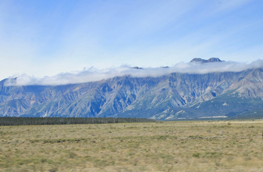
As you approach Haines Junction, you begin to see more and more of the St. Elias Mountains. This mountain range is part of Kluane National Park and Reserve, and it includes some of the tallest peaks in Canada, like Mount Logan.
For us, it was a long day waking up early to take the ferry from Juneau and driving about 4 hours, so we didn’t have much time to explore Haines Junction that night. However, this is a great home base for exploring Kluane National Park! You could opt to stay here for more than just the night if you want to spend more time exploring the park in depth.
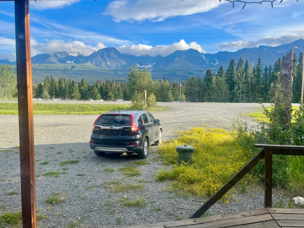
There are numerous hotels at Haines Junction but for us budget travelers, we stayed at Stardust Motel, which was a clean, simple motel with views of the mountains outside the door.
Day 8: Haines Junction to Tok
Kluane National Park
As mentioned above, the Haines Junction area is a great place to explore Kluane National Park from! Kluane National Park covers an area of 8,499 square miles (22,013 square kilometers) and became a national park in 1993. The park includes the highest mountain in Canada, Mount Logan (5,959 meters or 19,551 feet) of the Saint Elias Mountains. Also, mountains and glaciers cover 83% of the total area of the park.
As you can imagine, with the remoteness of the park, and the coverage of it in mountains and glaciers, there are essentially no roads into the park itself except for a few short ones to campgrounds. Nothing to complain about on that front, but just due to our schedule, we didn’t have the time to go for a deep dive into the park, which is a shame!
Due to the remoteness, most people will access it through one of the campgrounds, multi-day backcountry hikes, or through flightseeing tours. Taking a scenic flight interested us the most, allowing us to get as deep as we could into the park to see some of the largest mountains and the largest non-polar icefield in the world. We were torn between going on a flightseeing tour in Kluane or at Denali, but ended up choosing Denali due to wanting to see the highest peak in North America up-close. However, if we are ever back in the area and have the funds, we would love to do one in Kluane.
Right next to the Haines Junction visitor center is the Da Ku Cultural Center, a fantastic place to learn about the culture and history of the indigenous people of the local Champagne and Aishihik First Nations. There’s loads of information, artifacts, and pieces of art to get a better understanding of the First Nations people that were part of the area for thousands of years. It provides everything from general information (maps, trail information, details on park regulations) to information for those looking to go on longer backcountry hikes (weather conditions, backcountry permits, and wildlife sightings). The center also hosts educational programs, ranger-led hikes, and seasonal events that showcase the park’s flora and fauna. It’s free to visit, and both visitor centers have incredible views of the St. Elias mountains!
Similar to our International Falls hike above, we could not help ourselves to another short hike in Kluane National Park as we were driving through the incredible scenery. One cool thing about the Soldier Summit hike is that the opening ceremony for the Alcan highway occurred at Soldier Summit itself — on November 20, 1942. The highway was not “finished” at Soldier Summit, but it was decided that the opening ceremony area should be somewhere with a great view for the ceremony to do, and the hike definitely delivered! They even recreated the opening ceremony for the highway once again on the 50th year anniversary of the opening of the highway, on November 20, 1992.
Soldier’s Summit is a 2.2 mile out and back hike, with a bit of an elevation gain (around 800 feet). The trail starts in an alpine meadow, and the summit itself provides great views of St. Elias Mountains and Kluane Lake, with numerous informative signs at the summit surrounding the construction of the Alcan.
As you continue on past Soldier’s Summit towards the Alaska border, keep an eye out for wildlife as well as any pull-outs to take a break and get some photos of the incredible landscape.
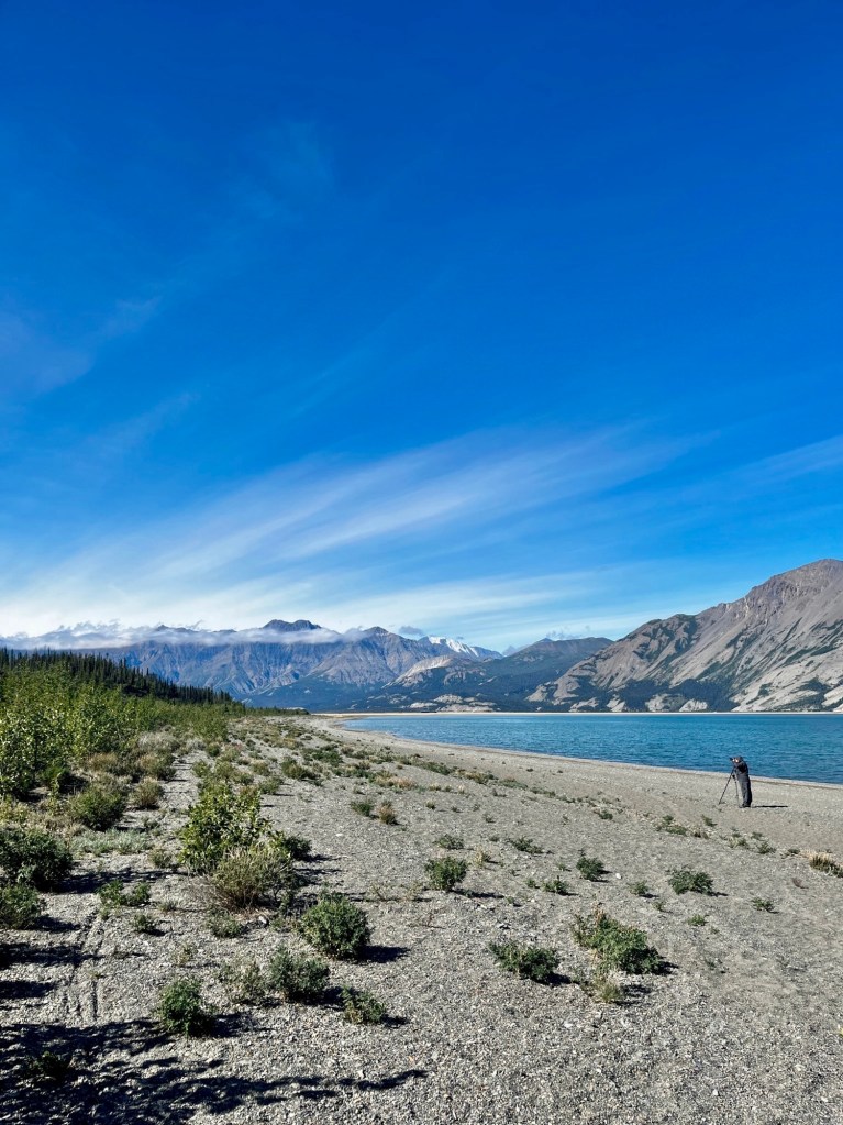
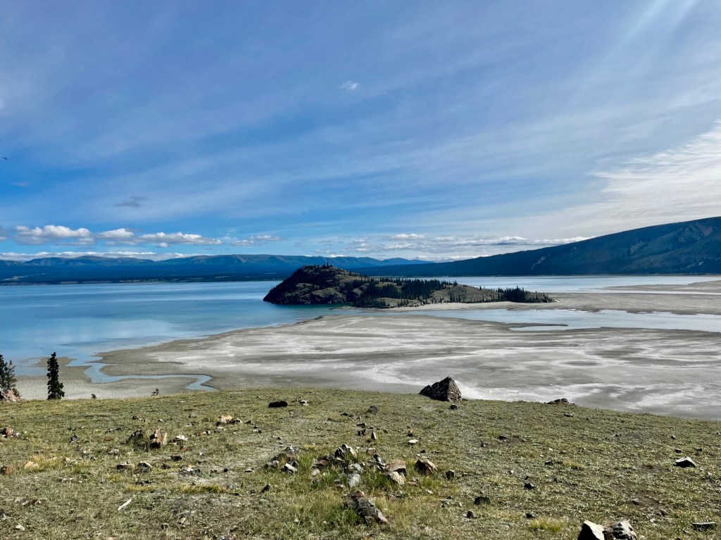
Destruction Bay
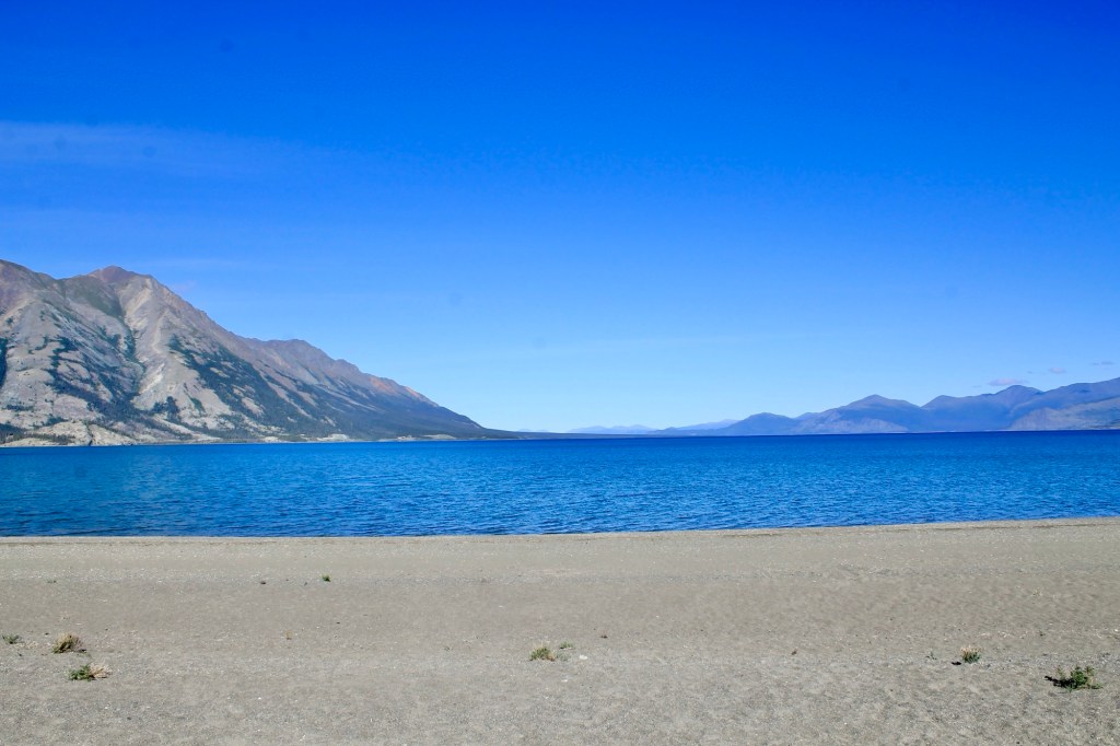
The only real “town” you pass on this portion of the drive is a small community located on the western shore of Kluane Lake, named Destruction Bay. Originally established as a construction camp during the building of the Alaska Highway in 1942, the town got its name due to the severe weather that caused damage to structures and equipment during the highway’s construction. Destruction Bay is a great place to stop on the way through the area if you need any gas, food, or coffee, and another perfect pull-off to take in the views of Kluane Lake, which is the largest lake in the Yukon.
If you are taking this journey at a slower pace than we did, there are also campgrounds and RV parks in the area for people looking for a place to stay the night.
Another quick stop, just north of Destruction Bay, is Burwash Landing, another small town that has the Kluane Museum of History, and small shops and cafes.
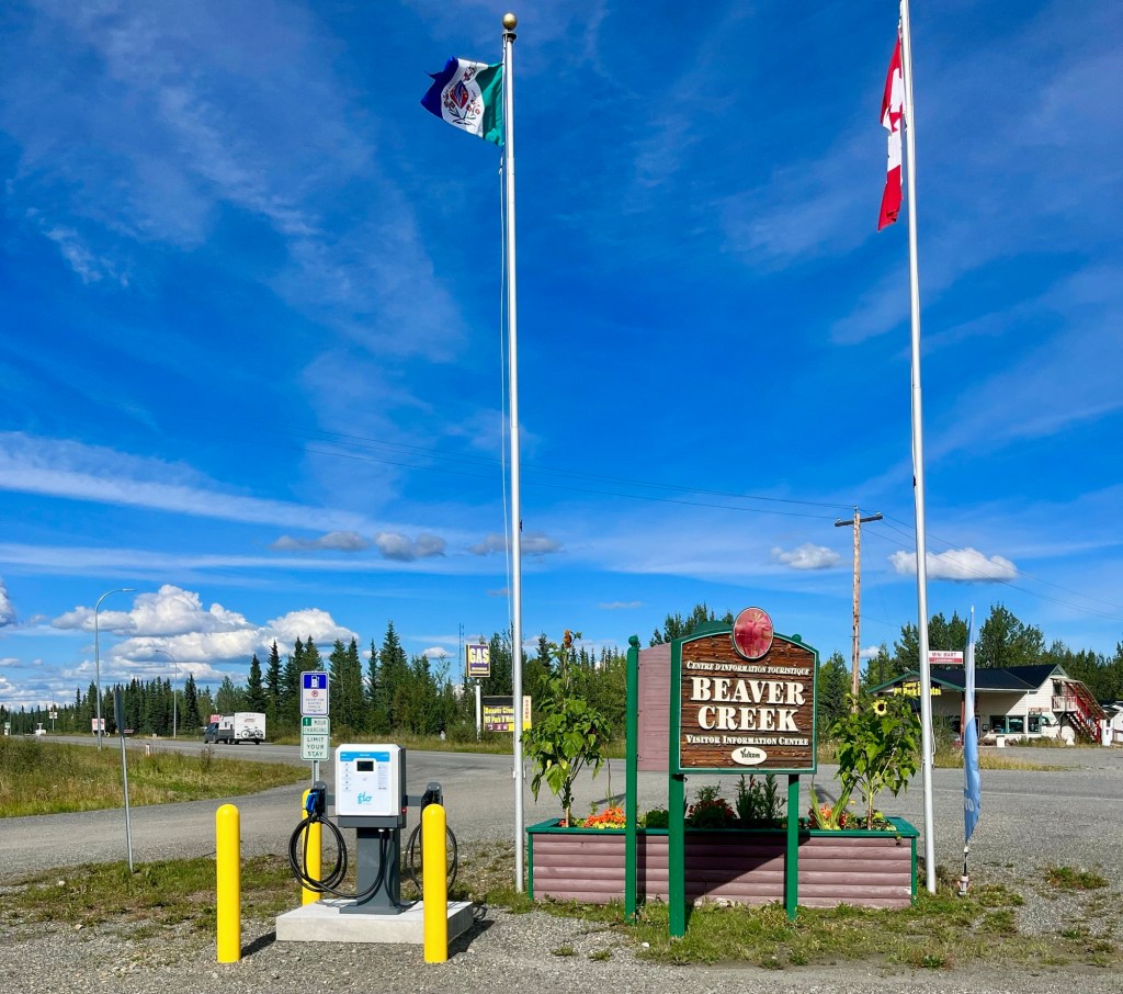
Beaver Creek
Beaver Creek is the last town before the Alaska-Yukon border where we filled up on gas and grabbed some food. It is the westernmost community in Canada. We stopped by the Visitor Center and the people working were so sweet and even gave us some Yukon luggage tags! We highly recommend stopping by if you have the time, as it was some of the nicest employees of any business we have met in our travels, no exaggeration. From Beaver Creek, it’s about a 30 minute drive until we’re back into Alaska.
Tok
Don’t forget to grab a picture of the Welcome to Alaska sign as you enter the state! Once you cross into Alaska, you enter into the Tetlin Wildlife Refuge, keep an eye out for any pull-outs and informational signs you may pass on the way. Also as always look out for wildlife!
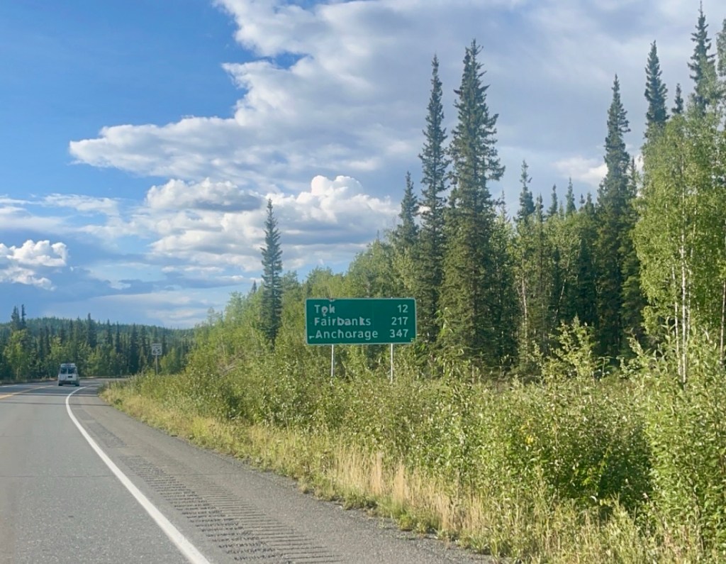
Once you cross into Alaska, it’s a short drive to Tok, known for being the first major Alaskan community while you’re driving on the Alaska Highway. Tok is located at a junction between the Alaska Highway and the Tok Cutoff, where you can either head south to Valdez and Prince William Sound, northwest to Fairbanks, or west to Anchorage (where we’re going!).
Also per usual, feel free to check out the local visitor center, the Tok Mainstreet Visitors Center, where you’ll find information about local attractions, such as tips for traveling through Alaska and information on nearby parks and recreation areas.
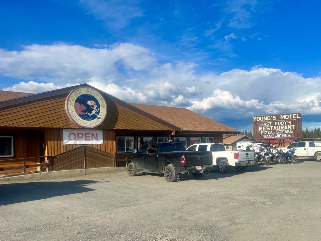
We stayed at Fox & Fireweed Cabins, which was a quiet and cute BnB, and grabbed dinner at Fast Eddy’s Restaurant. If you have the time, we would highly recommend stopping at Fast Eddy’s for a meal, it is hard to miss when you are in town, and it is a classic American road trip stop, with great crowds, friendly staff, and delicious food!
Day 9: Tok to Anchorage
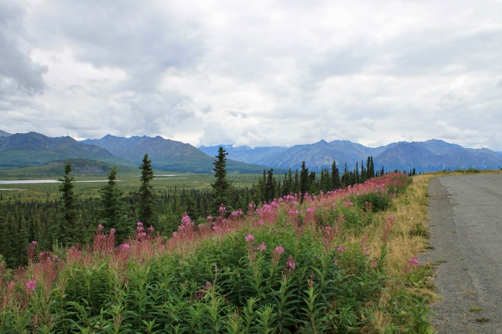
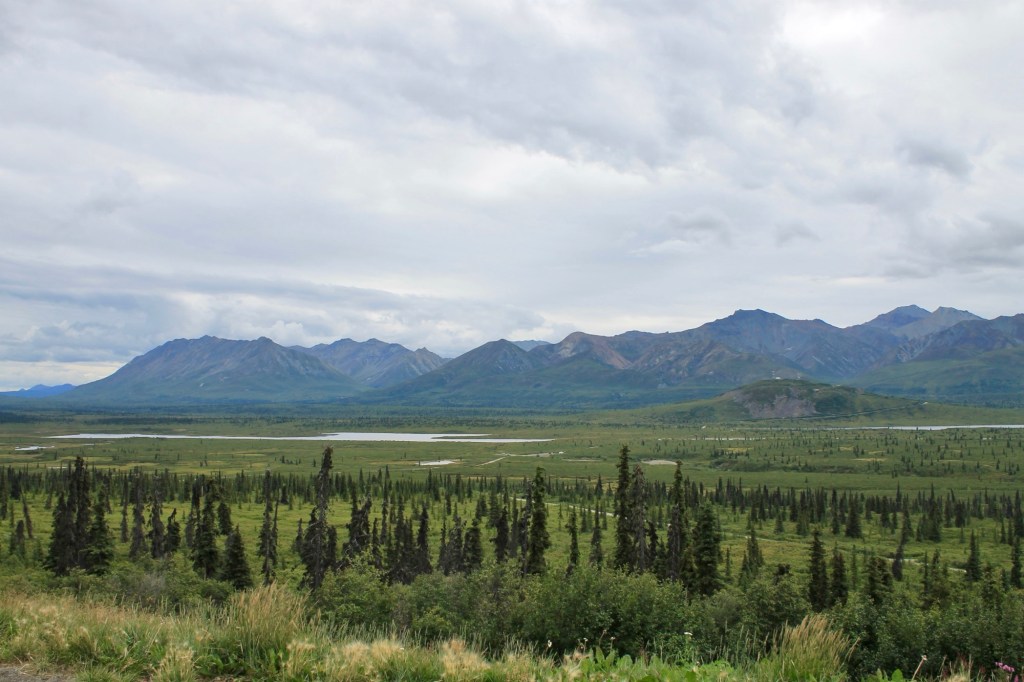
Now that we have turned off of the Alaska Highway towards Anchorage, we have joined the Glenn Highway, part of Alaska Route 1, a national scenic byway. On our last full day of driving of almost 6 hours, we continued to see the stunning views of the Wrangell-St. Elias mountains. I personally think this was one of the prettiest days driving on the Alaska Highway. The pictures speak for themselves!
Wrangell-St. Elias National Park
On this route you pass by the road to enter Wrangell-St. Elias National Park and Preserve, the largest national park in the United States. While you won’t directly enter the park on this route, the highway provides distant views of the park’s largest peaks, including Mount Sanford and Mount Wrangell. As always, keep a lookout for any viewpoints and pull-outs!
The turn-off towards Wrangell-St. Elias is at Glennallen, and if you have the time, you are able to drive just 15 minutes off the highway at Glennallen to head to the Wrangell-St. Elias Visitor Center if you are interested in learning more about the park !
Visitors can explore exhibits on the park’s unique geology, ecosystems, and cultural history. We unfortunately did not have the time to do much more besides exploring the visitor center itself, but there are also shorter trails nearby, such as the Boreal Forest Trail and Ahtna Cultural Trail.
Just like some of the other destinations mentioned in this article, Wrangell-St. Elias National Park is just another one of the places we would’ve loved to have more to explore! Hard to beat the beauty of the Alcan.
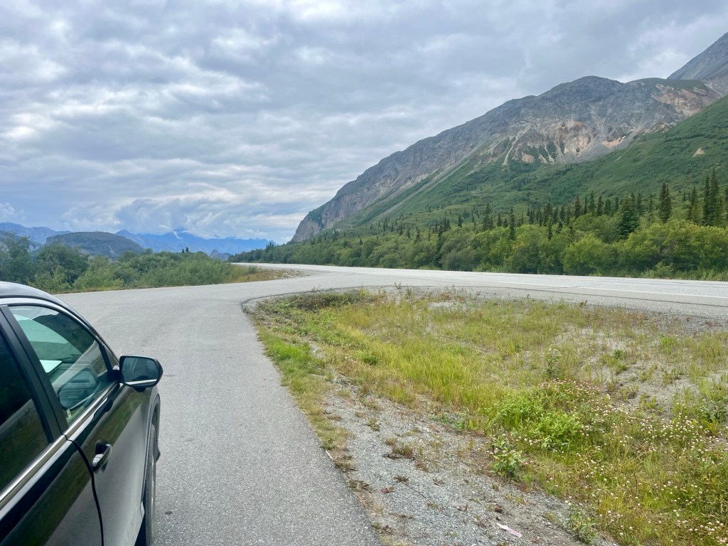
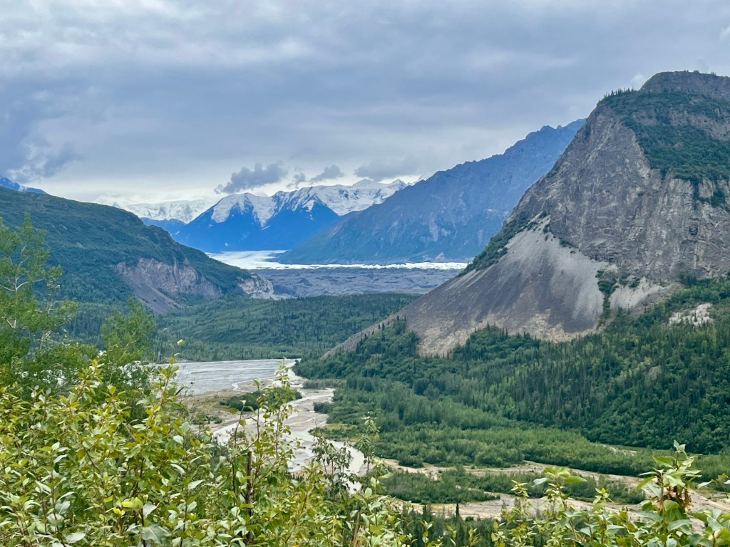
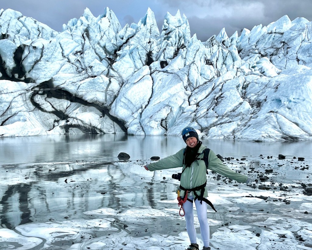
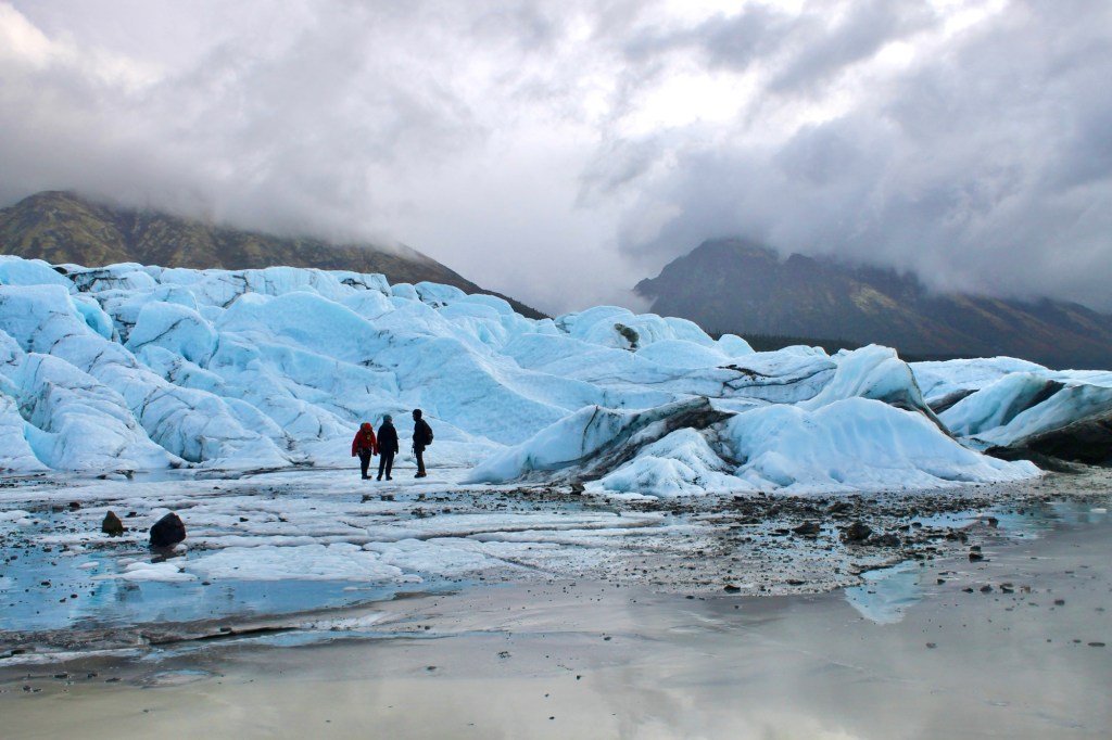
Matanuska Glacier
Once you’re approaching Glacier View, you can’t miss the vast river of ice flowing from the Chugach Mountains. Matanuska Glacier is one of Alaska’s most accessible glaciers at 27 miles long and offers glacier hiking tours to see the glacier up close, walk on it, and even drink crisp, fresh glacier water! It’s the perfect way to view Alaska’s glaciers without taking an expensive flight or going to more remote areas.
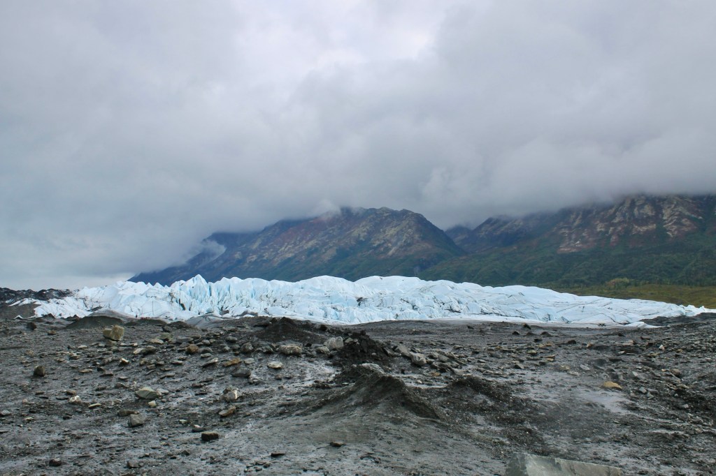
There are numerous spots along the highway to safely pull off for photos of its immense size, and unique formations. The Matanuska Glacier State Recreation Site is nearby as well, with picnic tables, a campground, and some short trails, and there are some other trails nearby such as Lion’s Head Trail to get closer to the glacier as well.
We hope to make an article one day with more details on the glacier itself via our glacier climbing tour! There are a few tour companies that allows you to hike on the glacier but we did the Adventure Trek with NOVA Alaska Guides. Highly recommend!
If you choose to spend the night near Matanuska Glacier, Glacier View is the town to stay at.
Palmer
Hard to believe, but after Matanuska Glacier, we are only 2 hours away from Anchorage! So at this point we may not be making any big stops, as during the rest of our time in Alaska we are heading back to a lot of these towns for day trips or to stay overnight.
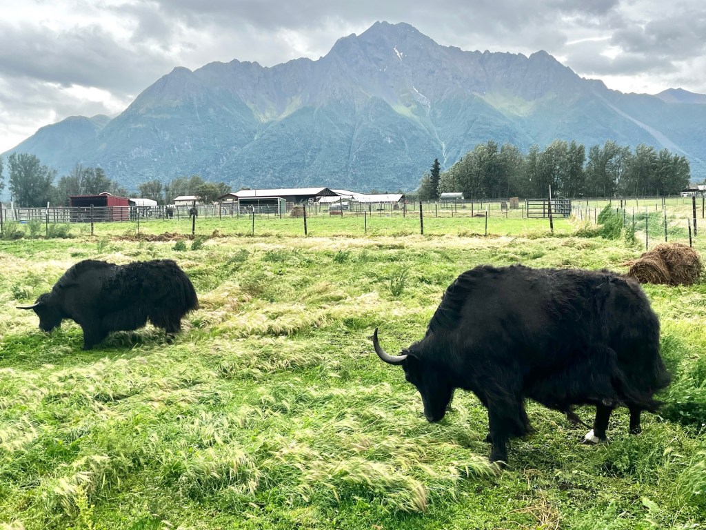
The last town you’ll drive through before reaching Anchorage is Palmer, an agricultural community surrounded by a gorgeous background of Pioneer and Twin Peaks and the Chugach Mountains. There are endless things to do and see in Palmer, but the main attractions we visited were the annual Alaska State Fair, Musk Ox Farm, and Reindeer Farm.
Anchorage
Only two more hours later and into more crowded highways, we have finally reached our home for the next month! As Alaska’s largest city, Anchorage was the perfect place for us to call our home base as we road trip around the state to Seward, Homer, Denali, and more. This city has a special place in my heart and I could go on and on about things to do, but you can read more about that in an upcoming article!
Where to Next?
Now that we’ve arrived in Alaska (on day 6), our first town is Skagway to spend the night before taking a ferry to Juneau. It’ll be our first time car camping (or camping in general, for that matter) and we would be sleeping in the front seats because we hadn’t gotten a car mattress yet and still had all our luggage in the car. What a way to start our time in Alaska!
Thanks for reading my little blog! 🙂 Have you driven the Alaska Highway or planning a trip there? Send me your thoughts about what you loved the most or are most excited about! If you have any questions, feel free to leave a comment.
Pin my Alaska Highway itinerary for later!

share your thoughts!